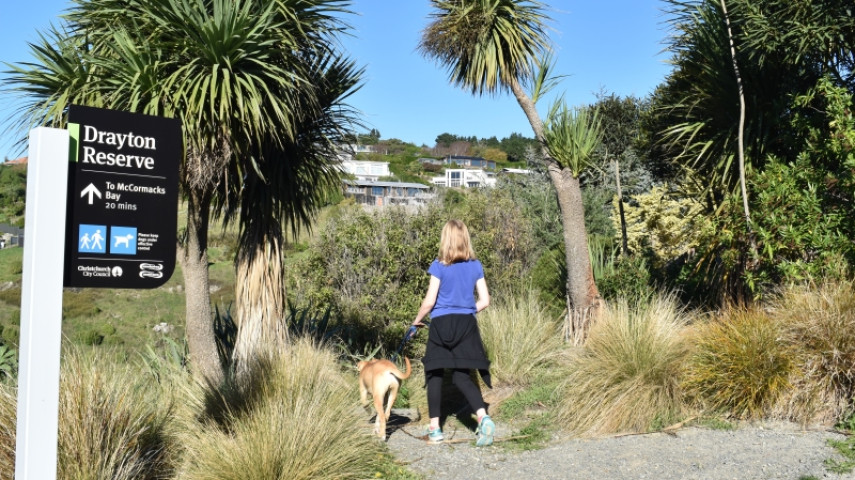
Drayton Reserve consists of a popular track that rises from McCormacks Bay to Mount Pleasant Road.
| Start | First hairpin on Glenstrae Road, Mount Pleasant |
|---|---|
| Finish | Craigieburn Lane, Mount Pleasant |
| Distance | 30 minutes one way |
| Time | 1.1 km |
| Dogs | Under effective control |
| Description |
Enter the reserve from near the first hairpin bend on Glenstrae Road. The track rises gently through the reserve with many additional branch tracks connecting to nearby roads and properties. There are ongoing efforts to re-forest Drayton Reserve and you will spot many new totara, ngaio and kanuka plantings as well as a number of native birds such as silver eyes, grey warbler, fantails and bellbird. The track finishes with a zig-zag incline up to Mount Pleasant Road. Get ready for this track using Plan My Walk(external link) by the NZ Mountain Safety Council. You can find track alerts, weather forecasts, trip reviews and a packing list, so you are set for your adventure. |
Walking tracks
Shared use
Connecting tracks
Closed

Parking

Bus stop

Toilets
Water fountains
Accessible tracks

Challenging feature

Entry and exit point

Point of interest
Related news
Central city on full display after long rebuild
After the 15th anniversary of the 22 February earthquakes, we’re taking a look at different Council aspects of the rebuild, and how far we’ve come. Next up, the central city.
27 Feb 2026
Ōtākaro Avon River Corridor shines, grows since quake
In the wake of the 15th anniversary of the 22 February earthquakes, we’re taking a look at different Council aspects of the rebuild, and how far we’ve come. Next up, the residential red zone's Ōtākaro Avon River Corridor (OARC).
26 Feb 2026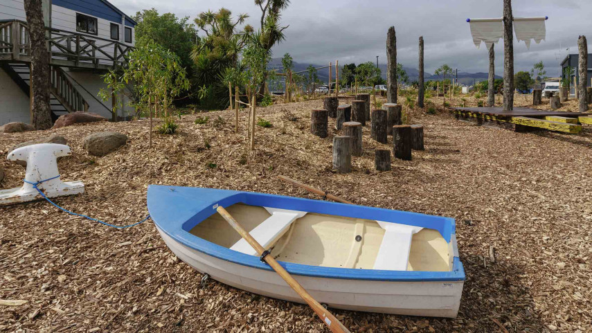
New play space at Lyttelton’s Naval Point now open
A ‘sinking ship’, monkey bars and dinghy are all features of a new play space at Naval Point.
14 Jan 2026