Draft Housing and Business Choice Plan Change

For our city, more housing choice is the way forward. We’re proposing changes to our District Plan to provide for our continued growth and prosperity.

Project status: Closed for feedback
Open for feedback: 11 April 2022 to 13 May 2022

Share this

Consultation on our proposed Housing and Business Choice Plan Change (PC14) opened on 17 March 2023 and you can provide feedback here.(external link) 

Early feedback has now closed

People were able to provide early feedback on the proposed Draft Housing and Business Choice Plan Change, from April 11 to 13 May.

During this time we heard from 575 individuals and groups. You can read their feedback here. [PDF, 7.2 MB]


Council meeting 8 September

A staff report went to Council on 8 September and recommended that the Council:

         1. Approve the public notification of Plan Change 13 Heritage and its associated evaluation report (prepared in accordance with            section  32 of the RMA) as included in attachments to this report, pursuant to Clause 5 of Schedule 1 of the RMA.

  1. Approve the public notification of Plan Change 14 Housing and Business Choice and its associated evaluation report (prepared in accordance with sections 32 and 77J-77R of the RMA) as included in attachments to this report, pursuant to Clause 5 of Schedule 1 of the RMA.
  2. Authorise Head of Planning and Consents to make any necessary minor corrections or amendments to the Proposed Plan Changes 13 and 14 or their evaluation reports and appendices, until the date of notification, to improve the clarity, accuracy or consistency of the documents.
  3. Authorise Head of Planning and Consents to make other consequential changes to chapters of the District Plan not otherwise affected by Plan Changes 14 and 13 and to approve those documents for notification.

At the meeting the Council voted against(external link) notifying the proposed Housing and Business Choice Plan Change (PC14).

To view the historical Draft Plan Change documents

Agenda items for 8 September Council meeting

Plan Change 13

Plan Change 13 and 14 Qualifying Matters: Residential Heritage and Character Area Maps [PDF, 19 MB]
Plan Change 13 Residential Heritage Areas - Contributions Maps [PDF, 7.6 MB]
Plan Change 13 Residential Heritage Areas - Aerial Maps [PDF, 18 MB]
Plan Change 13 Heritage Aerial Maps New Items [PDF, 14 MB]
Plan Change 13 Heritage Aerial Maps - Updated Existing Items and Settings [PDF, 11 MB]
Plan Change 13 Schedule of Significant Historic Heritage Items - Rules Package excluding Appendix 9.3.7.2 [PDF, 980 KB]
Plan Change 13 Schedule of Significant Historic Heritage Items [PDF, 853 KB]
Plan Change 13 Statements of Significance New Interiors [PDF, 4.6 MB]
Plan Change 13 Statements of Significance New Items [PDF, 6.4 MB]
Plan Change 13 Statements of Significance Updates to Existing Items [PDF, 3.9 MB]
Plan Change 13 Residential Heritage Areas Heritage Reports (Section 1) [PDF, 31 MB]
Plan Change 13 Residential Heritage Areas Heritage Reports (Section 2) [PDF, 2.1 MB]
Plan Change 13 S32 Plan Change 13 Historic Heritage (Section 1) [PDF, 31 MB]
Plan Change 13 S32 Plan Change 13 Historic Heritage (Section 2) [PDF, 31 MB]
Plan Change 13 S32 Plan Change 13 Historic Heritage (Section 3) [PDF, 24 MB]

 Plan Change 14

Plan Change 14 Chapter 1 Introduction [PDF, 928 KB]
Plan Change 14 Chapter 2 Abbreviations and Definitions [PDF, 2.2 MB]
Plan Change 14 Chapter 3 Strategic Directions [PDF, 687 KB]
Plan Change 14 Chapter 5 Natural Hazards [PDF, 1.3 MB]
Plan Change 14 Chapter 6 General Rules and Procedures [PDF, 1.7 MB]
Plan Change 14 Chapter 7 Transport [PDF, 3.2 MB]
Plan Change 14 Chapter 8 Subdivision, Development and Earthworks [PDF, 6.2 MB]
Plan Change 14 Chapter 9 Natural and Cultural Heritage [PDF, 30 MB]
Plan Change 14 Chapter 13 Specific Purpose Zones [PDF, 1.7 MB]
Plan Change 14 Chapter 14 Residential [PDF, 11 MB]
Plan Change 14 Chapter 15 Commercial [PDF, 2.9 MB]
Plan Change 14 Chapter 16 Industrial [PDF, 581 KB]
Plan Change 14 Planning Maps (Section 1) [PDF, 31 MB]
Plan Change 14 Planning Maps (Section 2) [PDF, 9.7 MB]
Plan Change 14 S32 Part 1 (Overview and High Level District Issues) [PDF, 6.7 MB]
Plan Change 14 S32 Part 2 Qualifying Matters District Plan Chapters 8 9 14 (Section 1) [PDF, 31 MB]
Plan Change 14 S32 Part 2 Qualifying Matters District Plan Chapters 8 9 14 (Section 2) [PDF, 31 MB]
Plan Change 14 S32 Part 2 Qualifying Matters District Plan Chapters 8 9 14 (Section 3) [PDF, 31 MB]
Plan Change 14 S32 Part 2 Qualifying Matters District Plan Chapters 8 9 14 (Section 4) [PDF, 31 MB]
Plan Change 14 S32 Part 2 Qualifying Matters District Plan Chapters 8 9 14 (Section 5) [PDF, 19 MB]
Plan Change 14 S32 Part 3 Residential District Plan Chapter 14 (Section 1) [PDF, 31 MB]
Plan Change 14 S32 Part 3 Residential District Plan Chapter 14 (Section 2) [PDF, 4.3 MB]
Plan Change 14 S32 Part 4 Commercial District Plan Chapter 15 and Industrial Chapter 16 [PDF, 30 MB]
Plan Change 14 S32 Part 5 Transport District Plan Chapter 7 [PDF, 1.1 MB]
Plan Change 14 S32 Part 6 Subdivision, Development and Earthworks (District Plan Chapter 8) [PDF, 2 MB]
Plan Change 14: S32, Part 7 Tree Canopy Cover - Financial Contributions (District Plan Chapters 2, 3 and 8) [PDF, 11 MB]


Providing more housing choice is the way forward

Population growth, housing issues – including housing affordability – and climate change are prompting a re-think of some of Ōtautahi-Christchurch’s planning rules. We’re proposing changes to our District Plan to provide for our continued growth and prosperity.

This is to bring our District Plan in line with government direction that has been given via the National Policy Statement-Urban Development(external link) (NPS-UD) and the Resource Management (Enabling Housing Supply and Other Matters) Amendment Act(external link) (The Act) to enable more development in the city’s existing urban footprint. 

Some of the changes we’re making are legal requirements of the new national direction and cannot be influenced by the Council, or community feedback. However, there are some changes that can be adapted based on our residents’ views such as building heights above the new baselines. See more under proposed zones.

Read more on the Technical information

Printable consultation document [PDF, 4.4 MB] 

Webinar recordings, slides and Q&A documentation for all Draft Plan Changes - September 2022

View the slides, Q&A and Webinar here(external link)

Our growth challenge

Our population is growing and we need to set Ōtautahi-Christchurch up for the future. Over the next 30 years, it’s predicted we’ll need over 50,000 more houses in Ōtautahi-Christchurch to ensure everyone has a place to live – we’re planning for that now.

This means re-thinking some of our planning rules to allow more housing choice to accommodate the diversity of people who choose to live in our city. We also need to provide greater opportunities for business development in Ōtautahi-Christchurch.

With families getting smaller and people getting older, housing preferences are changing. Future development of our city needs to provide appropriate housing and commercial centres – while also addressing issues such as climate change and housing affordability, for the good of future generations.  

We also need to make changes to our District Plan to comply with new government direction from the National Policy Statement on Urban Development 2020 (NPS-UD) and the Resource Management (Enabling Housing  Supply and Other Matters) Amendment Act 2021. This direction requires us to enable more housing and development across residential zones with higher height limits within and around the city centre and suburban commercial centres.

We want to put more houses in the right parts of our city, close to our growing commercial centres, where there’s good access to services, public transport networks and infrastructure. Living within easy reach of work, school and shops makes getting around easier and helps cut transport emissions, which is better for the environment. Building more homes on our existing urban footprint also protects our precious, versatile soils.

Our recent Housing Survey showed that 57 per cent of people support changing the rules so that more homes can be built in areas that are already developed.

Some of the changes we’re making are legal requirements of the new national direction. They must be notified before 20 August 2022 and cannot be influenced by the Council, or community feedback. However, there are some changes that can be adapted based on our residents’ views.

Your feedback on what we’re proposing is important and will help us develop the draft changes to the District Plan that are not strictly dictated by the new national direction. The draft plan change will then go out for further consultation when it is formally notified before 20 August 2022.

How the District Plan works now

Under our current District Plan rules, only one house is permitted on most suburban residential properties in Ōtautahi Christchurch. More dense housing is permitted on some sites close to the central city and key suburban commercial centres. The height limit in our suburban areas is generally 8 metres high with some higher heights permitted closer to the central city and key suburban commercial centres. Developments that don’t comply with the rules require resource consent.


Our proposed plan

Under the Resource Management (Enabling Housing Supply and Other Matters) Amendment Act 2021 (the “Enabling Housing Act”), in most residential areas of the city resource consent will no longer be required to build up to three homes, up to 12 metres high (three storeys, depending on building design), from August 2022. These new rules are called Medium Density Residential Standards (MDRS).

The National Policy Statement on Urban Development 2020 (NPS-UD) requires even greater building development – both residential and commercial – to be allowed within and around the central city, suburban commercial centres and planned high frequency and capacity public transport. This is to enable more people to live near existing services, public transport networks, infrastructure and there is more scope for us to decide where and how much additional development should be enabled.

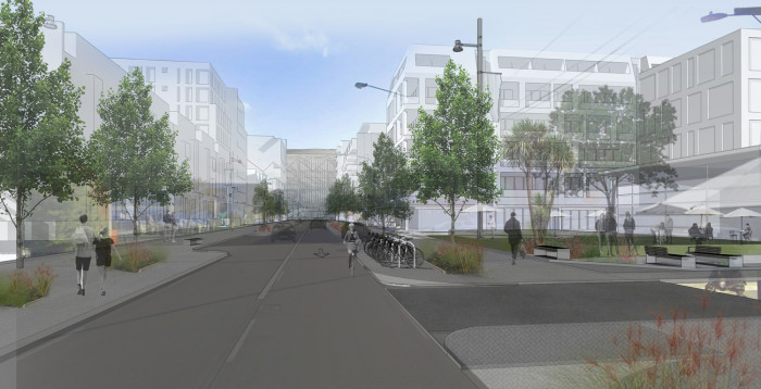
The proposed plan change creates a number of residential and commercial zones in the city, within which different heights of development are enabled for housing. Increased commercial development will be enabled in the central city and suburban commercial centres.

It is important to remember, although these changes allow for more housing to be built, this won’t happen city-wide overnight. Our city will gradually evolve as our population grows and demand for more and different types of housing increases.

In some areas of the city, the amount of increased housing allowed will be less than the three houses up to 12 metres in height that the MDRS enables, while some parts of the city may be exempt from rules enabling intensification. This could be because of their significant heritage or character value, or because of specific hazards they are susceptible to such as rockfall or flooding. These areas are identified in the draft plan change and are called Qualifying Matters.

Additionally, through the draft plan change, we’re proposing a mechanism that will help maintain our city’s trees as more homes are built. Financial contributions could be required from anyone developing land that do not retain or plant 20 per cent tree canopy cover on a site. These contributions will be used to plant trees on Council-owned land. We propose further protecting trees by making the listed protected trees in the current District Plan a Qualifying Matter under the new legislation.

We propose adding a district-wide engineering provision to the District Plan which will require anyone wanting to develop land to check water and sewer network capacity with us prior to planning a new development.

To speed up the opportunity to develop more housing, a new planning process called the Intensification Streamlined Planning Process (ISPP) has been introduced by the government. The public will be able to submit on the proposed intensification rules when the draft plan change is notified before 20 August 2022, but following hearings appeals will only be allowed on points of law.


Proposed zones

The proposed plan change renames a number of residential and commercial zones in the city and enables more and higher housing to be developed. In some zones, this will still be subject to a resource consent being obtained. 


Medium Density Residential Zone

Medium Density Residential Zone - The base-line for increasing housing

This zone is legally required by the Enabling Housing Act and must be applied to most residential areas of Ōtautahi Christchurch. This Act introduced Medium Density Residential Standards (MDRS) that will allow development of up to three homes of up to 12 metres on a single property, without resource consent.

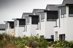
Indicative illustration only: Medium Density Residential Standards (MDRS).

This zone is also applied to Lyttelton, as it is part of the same labour and housing market as Ōtautahi- Christchurch. Akaroa and Diamond Harbour do not meet the same criteria, and are therefore not included. The zone will take legal effect from when the plan change is formally notified, which must be before 20 August 2022.

Any development will still need to reflect site-specific constraints, known as Qualifying Matters (refer to the section on Qualifying Matters in this document).

Subdividing

  • A subdivision of land that is currently vacant will need to have lots that are at least 400 metres².
  • There will be no minimum allotment size when subdividing around an existing house or planned consented house, for the site that contains the house.
  • Subdivision that includes existing or consented homes will not need any form of written approval from neighbouring properties, or notification of the intent to subdivide.

Building height and occupation of land

Buildings that could be constructed without a resource consent may: 

  • Be up to 12 metres high, with a recession plane taken from 4 metres above the property boundary and at a 60° angle.
  • Be setback 1.5 metres from the front boundary and 1 metre from side and rear boundaries.
  • Cover up to 50 per cent of the site.
  • Have ground floor units with at least 20 metres² of dedicated outdoor living space, or at least a combined 8 metres² on other floors, such as a balcony, or roof terrace.
  • Have at least 20 per cent of the site grassed or planted, or 20 per cent canopy cover.
  • Have at least 20 per cent of the street-facing façade glazed.
  • Be compliant with other new standards, including updated fencing standards.

Proposed buildings that do not follow all of these requirements will need a resource consent, which may need neighbours approval but will not need to be publicly notified.

Resource consent is also needed when four or more units are constructed. However, no written approvals from neighbouring properties or notification is needed when complying with the above rules.

There is limited ability for the public to feedback to change the rules for this zone, as they are legally required by government legislation.

Precincts within the Medium Density Residential Zone

We’re proposing some areas of the city within the Medium Density Residential Zone will include precinct overlays. These precincts may enable more housing, higher heights or may have a different minimum lot size in areas such as the Port Hills.

Indicative illustration only: Medium Density Residential Standards (MDRS)

High Density Residential Zone

We’re proposing most of this zone will be concentrated within and around the central city, due to the requirement to enable buildings of at least 20 metres in height within a walkable catchment (1.2 kilometres) from the City Centre Zone.

It will enable the construction of apartment buildings and multi-storey flats of up to 32 metres, with greater heights enabled in closer proximity to the central city and suburban commercial centres such as Hornby, Riccarton and Papanui.

Subdividing

Vacant sites subject to subdivision must have allotments of at least 300 metres².

  • There is no minimum allotment size when subdividing around an existing or planned house with a consent, for the site that contains the house.
  • Any subdivision that includes existing or consented homes does not need any form of written approval or notification from neighbouring properties.

Building height and occupation

Housing that could be constructed without a resource consent will:

Be up to 14 metres in height, subject to a recession plane taken from 4 metres above the boundary at 60° angle. Recession planes do not apply along the front of a site when constructing two or more dwellings, or where above 12 metres and setback at least 6 metres from side and rear boundaries.

  • Be set back 1.5 metres from front boundaries and 1 metre from side and rear boundaries.
  • Cover up to 50 per cent of the site.
  • Have ground floor units with at least 20 metres2 of dedicated outdoor living, or at least a combined8 metres2 on other floors, such as a balcony, or roof terrace.
  • Have at least 20 per cent of the site grassed or planted.
  • Have at least 20 per cent of the street-facing façade glazed.
  • Be compliant with other new standards, including updated fencing standards.

Housing that does not meet one or more of these standards will need resource consent and may need written approval from neighbouring properties, but will not be publicly notified.

Resource consent is also required when four or more housing units are constructed. However, no written approvals or notification is needed when complying with the height and other standards above.

Housing of between 14 and 20 metres will also be managed via resource consent, as follows:

  • Rules for housing that is up to 20 metres in height require open space and amenity by recessing upper floors and increasing outdoor living space at the ground level. When granting a consent, we will consider building dominance, privacy, shading, necessity of height, building modulation and building location relative to transport and amenities.
  • Rules for housing that is up to 32 metres in height will have the same controls as those up to 20 metres, but will also require these upper floors to be set back 6 metres from side boundaries and rear boundaries, and 3 metres from front boundaries. These form standards help reduce the effects from larger buildings. The Council will be able to consider the same matters when granting consent as above.
  • Buildings exceeding 20 metres will also need to be evaluated for their effect on wind.
  • The increased height limit of 32 metres is proposed to be limited to within a 10-minute walk (800 metres) from the central city, with areas outside of this limited to 20 metres.

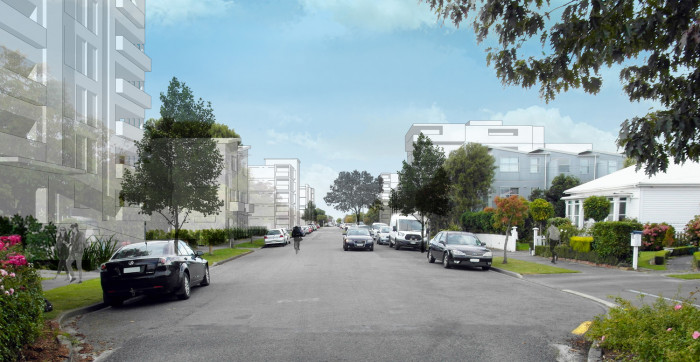
Indicative illustration only: High Density Residential Zone (20 metres max.)

Changes to Commercial Zones

Under the NPS-UD even greater building development than what is allowed under MDRS is to be enabled within and around the central city and suburban commercial centres. It is important to note that while greater development is enabled, resource consent will still most likely be required.

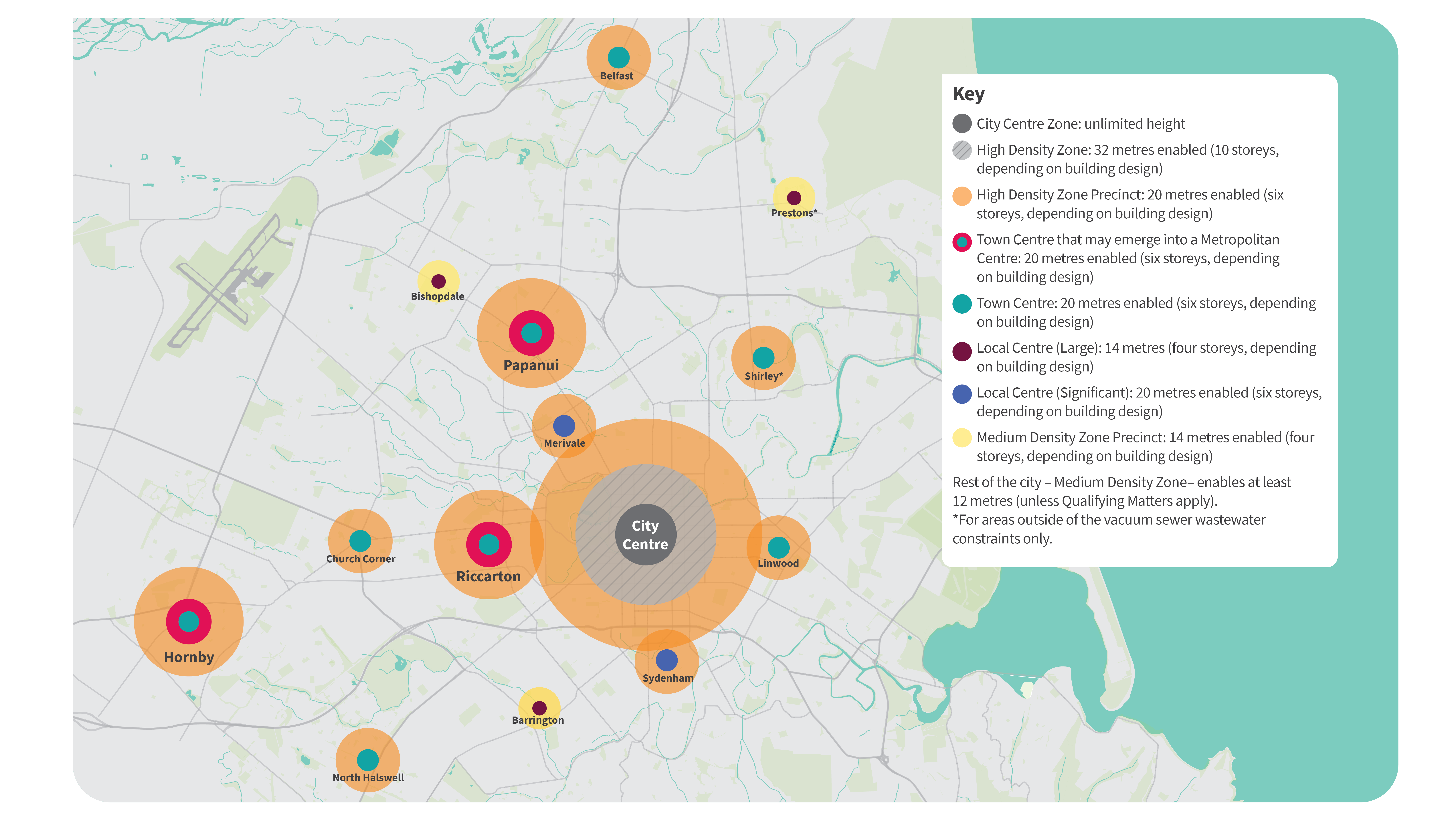
There is a hierarchy of commercial centres, based on the direction in the NPS-UD and national planning standards, and we are proposing different zones around these centres. The highest development – both residential and commercial – will be enabled in and around our biggest commercial centres, with this gradually reducing out to our smaller commercial centres.

The largest is our city centre, while the smallest are proposed in the District Plan as a ‘Neighbourhood Centre’.

The amount of housing proposed is based on access to services, public transport, walking and cycling networks, and infrastructure available in these commercial centres. It is important to note that the commercial centre boundaries are not changing, but the height of what can be built within and surrounding them is increasing.

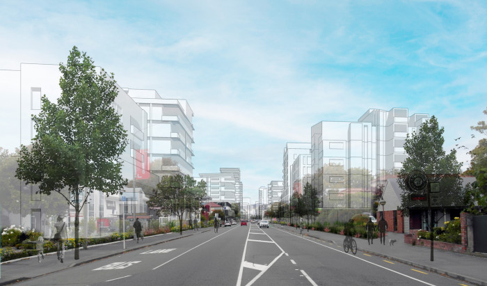
Indicative illustration only: High Density Residential and Commercial Zones (20 metres max.)


Heights within and around commercial centres

Building heights within each centre are set to align with the surrounding levels of increased housing that we are proposing to allow.

The table below shows the different centre types and building heights that we are proposing should be enabled, within and around them. It also identifies the suburbs with the different centre types.

Centre type

Building height

Neighbourhood Centre
Small isolated commercial areas, like local dairies
Increased to 12 metres, in line with Medium Density Residential Zone
Smaller Local Centres
For example, Redcliffs, Wigram, Fendalton
Increased to 12 metres, in line with Medium Density Residential Zone
Larger Local Centres
For example, Bishopdale, Prestons*, Barrington
Increase to 14 metres (four storeys, depending on building design), in line with being a precinct within the Medium Density Residential Zone
Significant Local Centres
Sydenham, Merivale
Increase to 20 metres (six storeys, depending on building design), in line with High Density Residential Zone
Town Centres
Linwood, Northwood, North Halswell, Shirley*, Church Corner
Increase to 20 metres (six storeys, depending on building design), in line with High Density Residential Zone
Emerging Metropolitan Centres
Riccarton, Hornby, Papanui
Increase to 20 metres (six storeys, depending on building design) in line with High Density Residential Zone
Metropolitan Centres#
Not applicable
No centres in Ōtautahi-Christchurch currently meet this definition
City Centre
(This area is currently the Commercial Central City Business
Zone in the District Plan)
Unlimited height

* For areas outside of the vacuum sewer wastewater system constraints only. Refer to the section on Infrastructure within this document for more information about these constraints.

# We consider that no commercial centres in Ōtautahi-Christchurch currently meet the definition of a Metropolitan Centre under the NPS-UD. However, centres such as Riccarton, Hornby and Papanui may develop into these in the future.

Subdividing

Subdivision thresholds within commercial centres are not changing from what the District Plan currently anticipates (i.e. 250 metres2 for suburban commercial centres and no minimum lot size for the central city). Subdivision thresholds around commercial centres will vary and will be in accordance with the relevant residential, industrial, or mixed-use zone provisions.

All subdivision applications (regardless of zone or allotment size) will trigger the need for resource consent.

The highest development – both residential and commercial – will be enabled in and around our biggest commercial centres, with this gradually reducing out to our smaller commercial centres.

City Centre Zone

Our city centre is our biggest commercial centre. This is where we want most development to occur and for the highest buildings to be located, such as high-rise offices and residential apartment blocks. This is based on demand for residential housing and easy access to services and public transport networks.

The NPS-UD also requires us to maximise development opportunities within the City Centre Zone. This includes everything currently zoned as Commercial Central City Business, which is loosely bordered by Madras Street, Tuam Street, Montreal Street, Kilmore Street, and either side of Victoria Street to Bealey Avenue.

Within a walking distance of at least 1.2km (15 minute walkable catchment) of the central city, we are proposing to enable higher densities with a maximum of 32 metres in close proximity to the central city and a limit of 20 metres beyond this.

Subdividing

We are continuing to provide no minimum site size for subdivision in the Central City Zone. This is not changing from what the District Plan currently provides for the Central City Business Zone.

Building heights and development

We propose setting no limit to building heights within the City Centre Zone. However, a resource consent will be required for most developments within the central city to enable us to assess the effects of shading, wind and urban design requirements. Developments will be evaluated on a case-by-case basis, with the aim of allowing as much as possible.

This is a shift from the current rules, which set maximum heights of up to 30 metres in some parts of the central city, based on post-earthquake economic evidence. This was to ensure that post-earthquake development happened across the whole central city, rather than just a few very tall buildings being built which absorbed all demand for housing and business activities.

Our central city recovery has progressed and these proposed rules aim to maximise use of the land we have by enabling higher buildings. This will align with what will likely be enabled in the central business districts of other larger New Zealand cities.

It is important to note that the Building Act 2004 will continue to require any development to appropriately consider seismic activity. This sits outside of the District Plan requirements.

Indicative illustration only: High Density Residential and Commercial Zone (14–20 metres max.)

Central City and Commercial Mixed-Use and Industrial Zones

We’re adjusting the requirements for new housing in some of the surrounding Central City Mixed-Use Zone and the Commercial Mixed-Use Zone. This is to create a city with its highest buildings at its centre and gradually decreasing in height as development moves into the suburbs. The amended provisions will promote more housing variety, quality design and low emissions living.

The proposed amendments also include:

  • Adding provisions that support high quality outcomes for residential development in the Central City Mixed- Use and Commercial Mixed-Use zones.
  • Re-zoning Industrial General Zoned land, within close proximity of the central city, to Commercial Mixed-Use.
  • Introducing a Brownfield Overlay in the Industrial General Zone for land close to identified commercial centres that enables residential and mixed-use development.

Subdividing

The minimum lot size for subdivision in the Commercial Mixed-Use Zone will remain at 250 metres², while the Central City Mixed-Use Zone will stay at 500 metres2.

Building heights and development

Within the Central City Commercial Mixed-Use Zone, permitted building heights will increase from 17 metres to 32 metres to match the surrounding High Density Zone (32 metres). The building heights permitted in the Commercial Mixed-Use Zone will increase to 20 metres to match surrounding areas. Rules to manage the effects of new buildings will be similar to the city centre. If you are proposing new housing in the Central City Mixed-Use Zone and Commercial Mixed-Use Zones, you will need to meet the residential development standards as set for the High Density Residential Zone.

Indicative illustration only: Central City Residential and Mixed-Use Zones (20 metres max.)


Areas unsuitable for increased housing (Qualifying Matters)

Not all parts of our city are suitable for the level of increased development that is enabled by The Act. Some areas have qualities, known as Qualifying Matters, which mean rules enabling increased development will not apply, or the level we enable increased development to is limited and remains subject to resource consent approval.

Strong evidence is required for something to become a Qualifying Matter, and becoming one does not provide blanket protection from housing intensification.

Meeting the threshold

The NPS-UD criteria for Qualifying Matters includes matters of national importance, nationally significant infrastructure, heritage and public open space. Development restrictions need to generally be confined to a specific location and alternative levels of intensification proposed.

We are able to consider ‘other matters’ as grounds for restricting development. However, this requires a significant amount of evidence, including site-by-site evaluation and full consideration of what housing or business capacity is likely lost if we stop or limit more homes being built. We’d also require an options analysis for how higher densities can still be achieved.

Proposed Qualifying Matters

We propose that most of the District Plan’s current constraints on greater densities are kept.

New Qualifying Matters or matters that the Council is considering as ‘other matters’ currently within the District Plan include:

  • Character Areas (refer to Character Areas and Residential Heritage Areas section).
  • Schedule of Significant Trees (refer to section on Trees)

Features not currently in the District Plan that we’re proposing to introduce as Qualifying Matters are:

  • Residential Heritage Areas (refer to Character Areas and Residential Heritage Area section)
  • Vacuum sewer wastewater system constraint areas (refer to Infrastructure section)
  • Coastal hazards areas – there is a Coastal Hazards Plan Change. Find out more and give feedback online(external link)
  • 400v power line setbacks – A 5 metre setback is proposed to apply from most power lines on many streets. However, the evidence base for this is still being developed and will be available when the plan change is formally notified before 20 August 2022.
  • Lyttelton Port’s Hillsborough City Depot surrounds – this seeks to protect the industrial operations of the port depot by restricting the number of houses exposed to noise. However, the evidence base for this is still being developed and will be available when the plan change is formally notified before 20 August 2022.
  • Radio Communication Pathways for the Justice and Emergency Services Precinct – there is a Radio Communications Pathways Plan Change. Find out more and give feedback online.(external link)

Infrastructure

Our water, stormwater and wastewater sewer systems will need to support more housing based on growth projections for the next 50 years. In most parts of the city our major pipes have enough capacity to accommodate increased growth.

However, increased growth in some areas with less capacity may mean that some infrastructure projects need to happen sooner than planned.

In most cases, interim measures can be put in place or minor local upgrades can be incorporated into the development plans – as is the current practice.

Existing infrastructure constraints

We have identified wastewater system constraints in Shirley, Aranui and Prestons and propose that these areas be listed as exempt with reduced densities of housing, as Qualifying Matters.

The three suburbs had vacuum sewer wastewater systems installed post-earthquake because they cope better with liquefaction and land settlement. The system was designed for the housing intensification that was allowed at the time. Since then, the Ōtautahi-Christchurch District Plan has allowed more intensification in the Shirley area than what the vacuum sewer wastewater system was designed for.

The vacuum sewer pipes in Shirley and Aranui have reached capacity, which means that no more additional development can be accommodated in the areas serviced by the vacuum sewer wastewater system. The situation is exacerbated by high inflow and infiltration (water getting into the system from outside sources such as cracked pipes on private property or through vacuum connection points) from many properties within these catchments.

This means for most of the Shirley and Aranui area, we can only accept like-for-like development and for Prestons, development must align with the Prestons Sewer Master Plan. Anyone wanting to develop land should talk with Council staff to see what can be accommodated.

District-wide engineering provision

We propose adding a district-wide engineering provision to the District Plan which will require anyone who is wanting to develop land to check water and sewer network capacity prior to planning a new development.

Financial contributions

Changes to the Resource Management Act mean we are now able to ask for financial contributions from anyone looking to develop land, even when a resource consent is not required (as per the new direction of the Enabling Housing Act).

Financial Contributions differ from Development Contributions, which are charged through the resource consenting process to ensure anyone developing land pays a fair share of the cost of providing additional infrastructure.

Development Contributions are narrower in scope, and are used to recover the costs for things like new assets or increased capacity. Financial Contributions can be collected to manage the direct impacts of a particular development. Councils can charge anyone developing land both Financial Contributions and Development Contributions, but cannot recover more than the financial impact of the development.

We’re proposing that anyone wishing to develop land may need to pay financial contributions to help mitigate some of the adverse effects that increased housing could cause. The first area we are looking to manage with the help of Financial Contributions is our city’s tree canopy.

We’re proposing that if anyone wanting to develop land does not retain or plant 20 per cent tree canopy cover on a site they will be charged a Financial Contribution. These will be used by us to plant trees on Council- owned land.

We’re also exploring opportunities to require Financial Contributions within vacant greenfield areas (previously undeveloped land) where density targets are not achieved, and also from Crown development.

Character and Residential Heritage Areas

Both Character Areas and Residential Heritage Areas are proposed as Qualifying Matters.

Character Areas, identified in the District Plan as a Character Area Overlay, are residential neighbourhoods that are distinctive from their wider surroundings and are considered to be worthy of retaining.

There are currently 15 Character Areas, which were last reviewed in 2015 – on the basis that at least 80 per cent of the properties in the area contributed to the character values that made it special. Following a recent review as part of the draft plan change, two of the character area overlays in Sumner (Clifton and Esplanade Character Areas) are proposed to be removed, as they no longer meet the criteria. We are also proposing seven should be reduced in size and six should remain the same.

Currently, changes to a property within a suburban Character Area will usually need a resource consent to assess any alterations that may affect the character of the property or the wider character area. The Council must grant the consent, but it can be subject to design conditions via a controlled activity consent.

In recognition of the status of a Qualifying Matter, we propose introducing a resource consent requirement as a restricted discretionary activity to help us better protect Character Areas. While some infill development will be allowed, the activity status will give the Council more flexibility in declining a resource consent where the design of a new house, or changes to an existing house aren’t in keeping with the Character Area.

Subdivision will also be more restrictive, depending on the zone and area. For example, within a certain Character Area an additional house may be allowed on an existing site, or to the rear on a new site, but it may be limited to 4 to 8 metres (one or two storeys, depending on building design). It may require a larger garden and existing trees to be retained, with the house or houses set further back from the street and other boundaries than would be allowed for in a general suburban area.

You can check the Character Area design guides to find out more information about the values online

Residential Heritage Areas (RHAs) are areas in neighbourhoods with buildings and features that are collectively (rather than individually) significant to the city’s heritage and identity, and are worthy of retaining. The rules we are proposing for these areas are new to the District Plan.

Our Draft Heritage Plan Change outlines the 11 proposed RHAs that we have identified as being exempt from as much intensification as other residential areas. These areas are: Inner City West, Chester Street East (Inner City), Englefield (Inner City East), Piko/Shand streets (Riccarton), Heaton Street (Merivale), Gosset/Carrington/Jacobs streets (St Albans), Wayside Avenue (Burnside), Wigram, MacMillan Avenue (Cashmere), Shelley/Forbes streets (Sydenham), and Lyttelton Township.

We also propose adding around 65 heritage buildings/ items and building interiors to the District Plan to be protected. As with existing scheduled buildings/items,these will require resource consents for more significant changes, such as building alterations, relocation or demolitions.

Do you have any feedback on our proposed Residential Heritage Areas? Find out more about the Heritage Plan Change and give feedback online(external link).


Trees

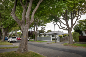
We know trees are important to people. They play a vital role in helping tackle climate change, reinforce our identity as the Garden City and provide a range of other essential environmental, economic, cultural and social benefits.

We’re working on ways – both through this plan change and also in other non-regulatory ways – to ensure that green spaces and trees can be retained as much as possible, while enabling more housing choice for our residents.

As part of this draft plan change, we propose introducing Financial Contributions, which would be required from anyone developing land to help fund increasing our tree canopy cover in the city. These contributions will be used to plant trees on Council-owned land. (see Financial Contributions in the infrastructure section) 

Additionally, we propose that the Schedule of Significant and Other Trees currently included in our current District Plan becomes a Qualifying Matter. We will be reviewing approximately 900 trees on the list to provide the necessary evidence required under the NPS-UD to be considered as a Qualifying Matter, before the plan change is notified before 20 August 2022.

A further review of the Schedule of Significant Trees to protect additional trees could be carried out as part of any subsequent plan changes.

Our Tree Policy, introduced last year, outlines how we manage and maintain trees in public open spaces. We’re also preparing an Urban Forest Plan that will provide a long-term vision and strategy to maximise the health and sustainability of the city’s urban trees and forests. It’s due to go out for community consultation later in 2022.

Other work to implement the NPS-UD

In addition to the intensification requirements that we are implementing, through this plan change, the NPS–UD also has other requirements for us to implement. We’re working with our partners in the Greater Christchurch Partnership (GCP) to:

  • create a new plan for our sub-region that will describe the kind of place we want for our future generations,
    and the actions we need to take over the next 30 years to make it happen.
  • develop a Business Case for future high frequency and capacity public transport (mass rapid transit). As the Business Case is still under development and the locations of any mass rapid transit stops has not yet been determined, the NPS–UD requirements for intensification around mass rapid transit has not been included in this plan change. Depending on the outcome of the Business Case, further changes to the District Plan could be undertaken in the future.

 Find out more about the Greater Christchurch Partnership(external link) 

Car parking requirements

Minimum car parking requirements were removed from the District Plan, as per the NPS-UD requirements, in February 2022.

Next steps

Following notification of the plan change before 20 August 2022 and public consultation, there will be hearings when submitters can be heard by an independent Hearings Panel – which are expected to take place in 2023.

All controls relating to MDRS will have immediate legal effect once the Council notifies the plan change.

However, proposed controls relating to intensification beyond this, such as within and around commercial centres, won’t come into effect until the final recommendation from the Panel is agreed to by the Council or determined by the Minister. This aspect needs to be completed by 20 August 2023.

The public will have an opportunity to make a submission on the proposed intensification rules during this process, but appeals will only be allowed following hearings on points of law. This follows the new Intensification Streamlined Planning Process (ISPP) introduced by the government legislation, which must be used to implement intensification policies quicker.

Decision-making process

1.

Pre-notification consultation - 11 April to 13 May 2022.

2.

The Draft Housing and Business Plan Change is notified (expected in March 2023) and the public can provide submissions. The MDRS rules have immediate legal effect from this date.

3.

Submissions on the notified Draft Plan Change are published.

4.

Further submissions can be made on the notified Draft Plan Change to support or oppose previous submissions.

5.

Independent Hearings Panel conducts hearings. The Council can choose to conduct optional pre-hearing mediation.

6.

The Hearings Panel provides the Council with its recommendations.

7.

The Council makes its decision. If the Council does not agree with the Hearing Panel's recommendations, the Minister for the Environment becomes the decisionmaker.

8.

The Draft Housing and Business Choice Plan Change becomes operative (early 2024).

Technical information

You can read more about the technical information supporting the proposed changes to the District Plan on our webpage(external link)


Other proposed District Plan changes

We welcome your feedback on these draft plan changes. This will help us shape the draft changes needed to bring our District Plan in line with government direction, ahead of formal consultation before 20 August 2022.

Draft Heritage Plan Change 

We are proposing that 11 new residential heritage areas across the city be identified for protection in the District Plan to recognise Ōtautahi-Christchurch’s special identity and adding around 65 buildings, items and building interiors to the Schedule of Significant Historic Heritage. Find out more(external link)

Draft Coastal Hazards Plan Change

We need to avoid the increased risk of harm to people and property from coastal hazards such as flooding, tsunami and erosion. Find out more(external link)

Draft Radio Communication Pathways Plan Change

We need to protect the airspace used for emergency radio communications by stopping development that blocks it. Find out more(external link)


Share this

Who to contact

How the decision is made

  • Closed for feedback

Takiuru ki ā mātou ratonga
Log in to our services