Pre-notification consultation – 11 April to 13 May 2022.
The Coastal Hazards Plan Change is notified before 20 August 2022 and public can provide submissions.
Submissions on the notified Plan Change are published.
Further submissions can be made on the notified Plan Change – late 2022 (to support or oppose previous submissions).
Independent Hearings Panel conduct hearings – 2023 (The Council can choose to conduct optional pre-hearing mediation).
Hearings Panel provides the Council with recommendations.
The Council makes its decision with the opportunity for appeals.
The Coastal Hazards Plan Change becomes operative.


 Here in Ōtautahi-Christchurch and Te Pātaka-o-Rākaihautū Banks Peninsula we are already experiencing the effects of climate change. The future is expected to bring warmer weather across all four seasons, more days of extreme wind, and more intense rainfall.
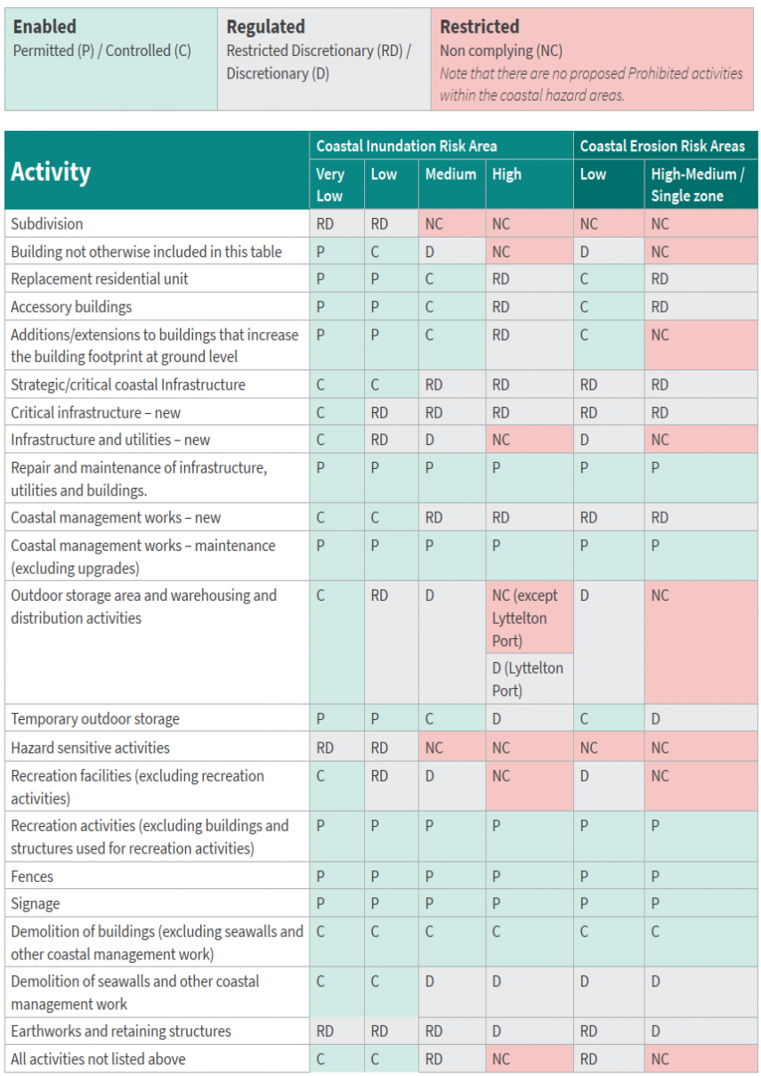
 It reflects the approach taken to other hazards in the District Plan; (Areas identified at a higher risk of river flooding that could cause harm are classified as High Hazard Management Areas. Similarly on the Port Hills, a graduated approach is taken with a more restrictive set of rules applying to properties subject to a higher risk of rock fall, cliff collapse and mass movement compared with other areas where there is a lower risk) and is consistent with international risk management best practice (ISO 31000: 2009, Risk Management – Principles and Guidelines).