Council operated cemeteries are open seven days a week, in Summer from 7am to 8pm, and in Winter from 8am to 5pm.
For casket and ash burials/interments in these cemeteries contact us or email cemeteries@ccc.govt.nz.
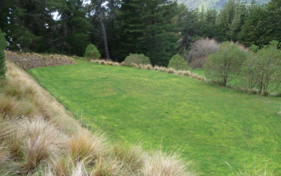
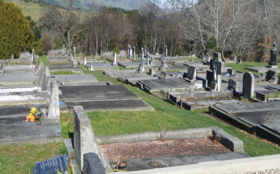
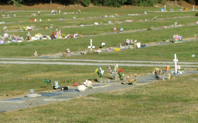
 Avonhead Park Cemetery (renamed Avonhead Memorial Cemetery in 2021) opened in 1983 and is still open for casket and ash burials. The cemetery is surrounded by established trees in a park-like setting.
Find this cemetery on the cemeteries map page (1st left off Avonhead Road after Withells Road).
- Map of the Avonhead Memorial Cemetery [PDF, 221 KB]
- Map of Avonhead Memorial Cemetery Lawn [PDF, 9.8 MB]
- Map of Avonhead Memorial Cemetery – Earthquake Memorial area [PDF, 2.3 MB]
Graves are marked either in the original lawn area with plaques or in the newer memorial area with headstones.
When the cemetery was developed in the late 1970s and early 1980s it was proposed that there would be a complete absence of memorials in the cemetery - no headstones or plaques. Instead, a metal tag was buried on the spot where the deceased lay and names were added to the memorial wall by the records room.
A metal detector could be utilised to track the location of specific graves. However, this scheme did not find favour with the community and the placement of lawn cemetery-style plaques was allowed. In 1993 additional areas were created allowing for upright memorials.
The cemetery is not laid out in denominational divisions, however, it is popular with the Polynesian and Asian communities and there are areas for children, stillborn and pre-born. The extension to the cemetery was opened in August 2009 and includes the Interment Site for the Victims of the 2011 Christchurch Earthquake.
Find these cemeteries on the cemeteries map page
Akaroa Anglican Cemetery
This cemetery is now full except for burials in pre-purchased plots and second interments.

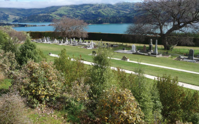
Akaroa Anglican Cemetery opened in 1857 and is reaching capacity. Please contact the cemetery staff regarding the availability of burial plots in this cemetery. The cemetery is located on an area of flat to rolling hillside adjacent to the Garden of Tāne overlooking Akaroa Harbour.
The cemetery is surrounded by dense native plants and exotic trees. There is a walking connection between Beach Road, the Garden of Tāne, the Akaroa Dissenters Cemetery and the Akaroa Catholic Cemetery.
The cemetery has associations with early history and the local community. Graves are laid out in an informal grid pattern on a gentle slope with an interesting range of headstones including some carved Totara grave markers.
Akaroa Catholic Cemetery
 Located on Onuku Road. The first known burial was in 1863. Please contact the cemetery staff regarding the availability of burial plots in this cemetery.
There are good visual connections to Akaroa Harbour from the top of the cemetery and it is separated from the adjacent Akaroa Dissenters Cemetery by a row of trees and a post and wire fence. Both cemeteries are adjacent to the Garden of Tāne. Dense native plantings and exotic trees surround the two cemetery sites. A network of walking tracks connects the cemeteries to the Garden of Tāne.
The cemetery has associations with the early history of the local community.
There are a variety of graves and headstones from the older Victorian-style plots with covers or kerbing to more recent modern upright stone memorials. The graves are orientated lengthwise in an east-west fashion and are stepped down the hillside in distinct blocks with mown grass paths.
Akaroa Dissenters Cemetery
 Akaroa Dissenters Cemetery is located immediately below the Akaroa Catholic Cemetery. It was opened in 1873.
The cemetery is now full except for burials in pre-purchased plots and second interments.
It is separated from the adjacent Akaroa Catholic Cemetery by a row of trees and a post and wire fence. Both cemeteries are adjacent to the Garden of Tāne. Dense native plantings and exotic trees surround the two cemetery sites. A network of walking tracks connects the cemeteries to the Garden of Tāne.
The cemetery has associations with the early history of the local community.
The grave plots in this cemetery appear to be older and more decorative than the adjacent Akaroa Catholic Cemetery. Laid in an east-west orientation across the steep slope, these graves are randomly clustered in blocks separated by mown grass strips.
Diamond Harbour Memorial Cemetery
 The Diamond Harbour Memorial Gardens Cemetery is located at Stoddart Point.
Map of the Diamond Harbour Memorial Gardens Cemetery [PDF, 398 KB]
Map of the green burial area [PDF, 2.3 MB].
The cemetery is open for ash and green burials.
Green burials are available to local residents of Diamond Harbour only.
Due to limited capacity, the pre-purchasing of any plot is not currently available.
The first known burial was in 2002.
Duvauchelle Cemetery
Duvauchelle Cemetery is located on the hill just outside the settlement of Duvauchelle, at the head of the Akaroa Harbour Basin.
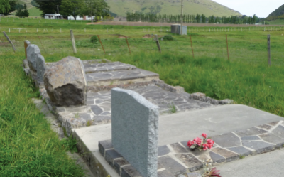
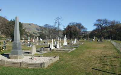
The cemetery was opened in 1881 and is still open for casket and ash burials. The cemetery is enclosed by a well-maintained macrocarpa hedge at the base of the slope. There are excellent views northwards over the whole harbour basin from the cemetery.
There are burial and ash plots available at Duvauchelle Cemetery.
The cemetery is set out in long, level rows of back-to-back headstones. There are distinctive family areas in the cemetery however, there is no evidence of denominational division. The cemetery has a variety of headstones from Victorian style to more recent modern upright memorial headstones. Most of the headstones and covers are in good condition.
Several mature oak trees are randomly located throughout the cemetery.
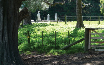
Kaituna Valley Public Cemetery
The cemetery (located adjacent to St Kentigens Church) opened in 1935 and is still open for casket and ash burials.
The rural location of this cemetery is significant as from all aspects of the site there are rural vistas which help provide a feeling of openness. Within the cemetery area which is operational, there are no trees. This is in contrast to the mature trees within the Churchyard.
The plots in the cemetery are laid out with rows back-to-back orientated in the same direction east/ west. The existing layout plan for the cemetery indicates denominational separation however, this has not been enforced. The headstones are mainly upright memorial headstones.
There are a few with simple low cross structures and some plaques are attached to a cut natural rock. The extensive use of Halswell Quarry stone as plot covers is a significant feature of this cemetery.
Le Bons Bay Cemetery
Le Bons Bay Cemetery opened in 1862 and is still open for casket and ash burials.
It is generally flat with a moist treed section near the western end. The rural location of the cemetery is significant, from all sides of the cemetery, there are rural vistas which helps provide a feeling of openness.
A large area of the cemetery is fenced off and either grazed or open for public access to the lagoon.
The cemetery has a formal layout with distinctive family areas. The cemetery has a variety of graves/ headstones from older Victorian style to more recent upright memorial headstones.
The cemetery has strong community associations and is maintained by the local community.
Little River Cemetery
It opened in 1878 and is still open for casket and ash burials.
Find this cemetery on the cemeteries map page (St Andrew Church, Little River Cemetery Rd).
Little River Cemetery is located adjacent to St Andrew's Church just outside Little River.
Map of the Little River Cemetery [PDF, 198 KB]
The cemetery is surrounded by exotic and native vegetation and has open views out to the Little River Valley and the foothills.
The cemetery is laid out in a grid with wide-mown paths and has a variety of headstones from the Victorian period with upright stone headstones to more recent granite and stone memorial styles, many of them with covered concrete covers.
A local cemetery with many family plots and strong connections to past and present communities.
Okains Bay Cemetery
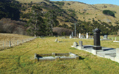
Okains Bay Cemetery opened in 1869 and is still open for casket and ash burials.
It is in a rural location, surrounded by paddocks, giving a strong feeling of openness. Over half the cemetery is fenced off and is currently grazed.
The cemetery has strong community associations and is maintained by the local community, the local parish and the Okains Bay Cemetery Board. The cemetery land is owned by the Crown. Investigations are currently underway to legalise the management of the cemetery by the appointment of local trustees.
The plots are laid out with double rows back to back facing northeast or southwest. Some of the older graves at the back of the cemetery are arranged at a different angle with no clear order to the paths.
The cemetery has a variety of graves/ headstones from Victorian / Edwardian styles with plots covered or kerbed to memorial styles.
Pigeon Bay Cemetery
The cemetery opened in 1865 and is still open for casket and ash burials.
Pigeon Bay Cemetery is located on a hill beyond the Pigeon Bay settlement. Large trees flank the entrance from Wilson’s Road and partially hide the cemetery, however once in the cemetery, it opens up with only a few specimen trees including oak and yew trees in the centre of the cemetery. The surrounding farmland gives the cemetery a feeling of openness.
Much of the cemetery is still undeveloped. The original plan shows distinct denominational areas within the cemetery site however this does not appear to have been followed, as the cemetery is now dominated by a couple of distinctive family areas. The cemetery caters primarily for members of the local community and is currently grazed by a local farmer.
The cemetery has a variety of headstones from older Victorian style with covers or kerbing to newer more recent modern upright stone memorials where the plots are covered with grass. Some recent graves have temporary fencing, possibly to prevent the stock from accessing them.
Wainui Cemetery
It opened in 1890 and is still open for casket and ash burials.
Wainui Cemetery is located several kilometres from the Wainui settlement.
Map of the Wainui Cemetery [PDF, 798 KB]
The cemetery has a rural feel and is located on a hill with panoramic views over Akaroa Harbour and out to the Akaroa Heads. There is little in the way of trees and amenity planting within the cemetery, with the exception of a stand of Birch and Oaks to the northwest of the site and scattered areas of regenerating native vegetation.
The cemetery has a unique layout with double rows of plots laid head to toe with an east/ west orientation. The headstones are all positioned facing towards the east and distinctive family groups seem to dominate. The cemetery has a variety of headstones from older Victorian style plots and more recent modern upright memorial headstones. Most of the headstones and covers are in good condition.
Other Banks Peninsula cemeteries
These Banks Peninsula cemeteries are administered by other bodies.
This is not considered a full list but incorporates all information currently available.
| Location | Cemetery | Administered by |
|---|---|---|
| Gebbies Valley | Church of The Epiphany | Mt Herbert Anglican Parish |
| Diamond Harbour | Governors Bay St Cuthbert's | Mt Herbert Anglican Parish |
| Le Bons Bay | Le Bons Bay | Local resident |
| Little Akaloa | Little Akaloa | Local Parish |
| Little River | Wairewa Māori Cemetery Pah Road | Wairewa Runanga |
| Okains Bay | Okains Bay | Local Parish |
| Onuku | Onuku | Onuku Runanga |
| Rapaki | Rapaki | Rapaki Runanga |
| Teddington | Teddington | Mt Herbert Anglican Parish Diamond Harbour |
 Belfast Cemetery opened in 1904. A new extension to the cemetery was opened in 2018 offering full burial and ash plots for pre-purchase and immediate interment.
Find this cemetery on the cemeteries map page (Corner Guthries and Belfast Roads).
- Map of the established Belfast Cemetery [PDF, 2.8 MB]
- Map of the new Belfast Cemetery extension [PDF, 367 KB]
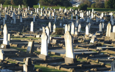
Originally a traditional cemetery with large traditional monumental-style headstones the cemetery was redeveloped in 1985 as a lawn cemetery, catering for upright and reclining memorials.
The memorial area of the cemetery is divided into rooms using a series of hedges. There are two distinctive areas in the cemetery, the children’s area and the Orthodox Russian area.
The rural location of the cemetery is significant and is part of the reason the cemetery has been so popular in the past. From all sides of the cemetery, there are rural vistas, which help provide a feeling of openness.
There are a number of established trees in the cemetery in keeping with the memorial park nature of the cemetery. Plantings include hedges, exotic and native planting. Existing buildings include a public toilet and a shed.
The recent purchase of additional cemetery land will enable further development in the short term.
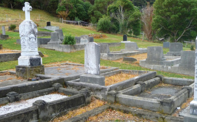
 Bromley Cemetery opened in 1918 because there was a need for burial places for the great number of victims of the influenza epidemic who perished in the last months of that year.
Find this cemetery on the cemeteries map page (Entrance off Linwood Avenue, corner Keighleys and Linwood Avenue).
Map of the Bromley Cemetery [PDF, 1.1 MB]
Plot maps of the Bromley Cemetery(external link)
Although it is approaching capacity it is still open for burials in pre-purchased plots and second interments only. The cemetery is located on ancient dunes which are still partly visible along Keighley’s Road.
The cemetery is a typical traditional monumental cemetery and is laid out in a highly regimented north-south orientation allowing graves to face due east or west. Narrow mown grass paths bisect the graves breaking the ‘mass’ of headstones and grave coverings into smaller rectangular ‘blocks’. Tree planting is largely confined to the edges of the cemetery and along the main vehicle drive.
The majority of monuments tend to be lower and more conservative than other cemeteries, providing a more orderly appearance which is accentuated by the uniformity of the Services section. There are many Returned and Services Association (RSA) graves, predominantly Great War veterans. Also found here is a memorial for stillborn children and one of the few mausoleums in Christchurch.
Linwood Cemetery opened in 1884, was the first Christchurch cemetery located outside the town ‘on sanitary grounds’.
 Find this cemetery on the cemeteries map page (entrance off Butterfield Avenue, next door to Bromley Park on Buckleys Road).
Map of the Linwood Cemetery [PDF, 1.6 MB]
Plot plans of the Linwood Cemetery(external link)
It was at one time called Christchurch Cemetery or Sandilands Cemetery, on account of the sandy soil, very suitable for digging. It has many large and interesting monuments, most of which are to the memory of early residents of the eastern suburbs. It has a Jewish section, including graves resited from the 19th century Jewish cemetery in Hereford Street. There are many notable people buried in the cemetery, along with a number of 'colourful' characters.
This cemetery, which has some exquisite examples of early monumental masonry, has fallen into disrepair as a result of vandalism and neglect. The sandy soils on this site do not provide a sound foundation for headstones and surrounds. An extensive restoration programme is currently in progress. This includes repairs to monumental masonry, path reconstruction, landscape enhancement and entrance redevelopment.
The Linwood Cemetery Working Party was set up as a vehicle for community input into planning and redevelopment and they have been active in work at the cemetery, along with Linwood Intermediate School.
The cemetery was the first Christchurch cemetery located outside the town ‘on sanitary grounds’ and is situated on what was once a large sand dune.
The cemetery is open to all denominations and is divided into specific areas. The layout of the cemetery is a variety of grid patterns despite the undulating topography.
The cemetery has a Jewish section, including graves re - sited from the 19th Century Jewish Cemetery in Hereford Street and is an important site for the Hebrew community as it is the only designated Jewish cemetery in Christchurch.
In 1884 the Council approved the construction of a tramway to the cemetery from the corner of Cashel and High streets and by 1885 had built a tramway hearse. Although now covered by asphalt, tram tracks survive beneath the main pathway within the cemetery.
There was a Sexton’s Lodge situated near the Butterfield Avenue entrance and a simple mourning kiosk. New gates similar in design to the original were built in 2005 at the Butterfield Avenue entrance.
The cemetery contains a range of graves from traditional monumental style to newer memorial style. There are a small number of elaborate sculptural monuments the most notable being the Fairhurst mausoleum, the peacock mausoleum and the Henry Thomson grave.
Plantings in the cemetery include exotic and more recent native planting, pines and macrocarpas which are concentrated around the perimeter of the cemetery.
Linwood Cemetery is available full except for burials pre purchased plots and second interments.The Jewish area. has available burial plots.
Linwood has available ash plots.
Further information on Linwood Cemetery(external link).
Linwood Cemetery Conservation Plan
- Linwood Cemetery Conservation Plan [PDF, 5.8 MB]
- Appendix 1 [PDF, 1.5 MB]
- Appendix 2 [PDF, 787 KB]
- Appendix 3 [PDF, 99 KB]
- Appendix 4 [PDF, 1.4 MB]
- Appendix 5 [PDF, 34 KB]
- Appendix 6 [PDF, 95 KB]
- Appendix 7 [PDF, 33 KB]
- Appendix 7a [PDF, 125 KB]
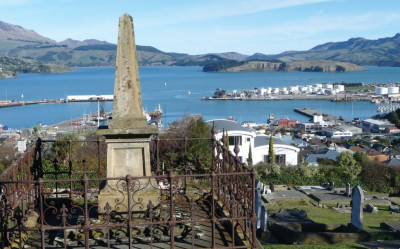
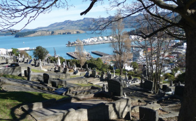
Lyttelton Anglican Cemetery opened in 1850.
 Find this cemetery on the cemeteries map page (87 Oxford Street, Lyttelton, with access also from Canterbury Street).
The cemetery is only available for casket and ash burials in pre-purchased plots and second interments however due to the large amount of recent earthquake damage in the cemetery any future interments in the cemetery will be on a case by case basis.
This cemetery has reached capacity with room only for interments in pre-purchased burial or ash plots.
The cemetery is formal Victorian in style, although the formality is lessened due to the topography of the setting. There are views to the port and wider Lyttelton Harbour from higher elevations in the cemetery.
The original headstones and grave surrounds are traditional in character. The more modern headstones generally located on the lower elevations are smaller and more contemporary in style. There is a recent influenza memorial.
Most of the vegetation is confined to the east and west boundaries and comprises of ash, sycamore and oak with some conifer species. Some of these exotic broadleaf species extend into the cemetery informally either side of the main path.
Lyttelton Catholic and public Cemetery also known as the Lyttelton Cemetery was opened in 1873.
 Find this cemetery on the cemeteries map page (Reserve Terrace, Lyttelton).
The cemetery is available for casket and ash interments in pre purchased plots and second interments however due to the large amount of recent earthquake damage in the cemetery any future interments in the cemetery will be on a case by case basis.
This cemetery has a Returned Services Area.
The cemetery is located on a steep hillside and is divided into three sections, Catholic, Services and public (from north to south). The graves are terraced on the hillside tightly laid in a grid formation with concrete terracing and steps with paths dissecting the various sections. The cemetery has a variety of graves/ headstones from older Victorian-style plots with covers or kerbing to newer memorial style, however, the older style is more predominant.
There is a significant amount of earthquake damage in the cemetery.
There are only ash plots available in this cemetery.
Memorial Park Cemetery opened in 1956 and is still open for casket and ash burials.
 Find this cemetery on the cemeteries map page (Corner Cypress Street and Ruru Road).
Memorial Park Cemetery maps
- All Blocks – aerial [PDF, 4 MB]
- Block 1 to 8 [PDF, 5.7 MB]
- Block 9 to 11 [PDF, 5.8 MB]
- Block 12 to 18 and ash plots [PDF, 7.3 MB]
- Block 20 to 22, 31 to 36 and ash plots 1 to 6 [PDF, 1.7 MB]
- Block 37 to 40 [PDF, 2.3 MB]
The cemetery has concrete beams for upright and reclining memorials. The cemetery is located on ancient sand dunes and has excellent, largely unobstructed views of the Port Hills.
There is a Muslim burial area on the eastern side of the site where the graves are aligned facing to Mecca (14 degrees west of north), a Māori burial area or urupā near the Ruru Road entrance, and a Russian Orthodox area to the western side and a Pacific Island area.
Tree planting is generally associated with the driveway areas, with a diverse mix of shrubs and trees around the central area surrounding the public toilet which is more or less centrally located.
Ruru Lawn Cemetery opened in 1941 and although approaching capacity it is still open for casket and ash burials.
 Find this cemetery on the cemeteries map page (off Ruru Road and Raymond Road - the cemetery is adjacent to an industrial area and Cypress Garden Reserve).
Map of the Ruru Lawn Cemetery [PDF, 267 KB]
Plot maps of the Ruru Lawn Cemetery(external link)
The cemetery is open and park-like in appearance. There is a mix of native and exotic tree, including conifers and broadleaves over 15.1427 hectares. Granite and bronze plaques are set either in the lawn or on concrete beams surrounded in loose crushed greywacke chip.
It has a large Returned Services area and a small Muslim burial area on the eastern side.
Ballantyne’s Fire Memorial is part of the Ruru Lawn Cemetery.
 Sydenham Cemetery opened in 1896 and is now full except for burials in pre-purchased plots. Ash plots are available for pre-purchase.
Find this cemetery on the cemeteries map page (end of Simeon Street, turn off Roker Street).
Plot plans of the Sydenham Cemetery(external link)
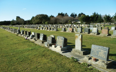
Situated alongside Somerfield Park the cemetery is typical of a traditional monumental cemetery with large stone memorials and plots with concrete covers, however, it also has standard upright modern memorials and plaques in the newer area. In the older area graves are laid out in formal planned rows, the newer area is much less formal.
There is an open-roofed shelter located on the site where the Sextons House was once located. There are no toilet facilities at the cemetery, however, there are public toilet facilities at the adjacent Somerfield Park.
We have sold out of plots in Waimairi Cemetery, which opened in 1909.
 Find this cemetery on the cemeteries map page (Grahams Road – between Cranbrook Avenue and Gregan Street – backs onto Kendall Avenue School).
Map of the Waimairi Cemetery [PDF, 480 KB]
The cemetery is available for casket and ash interments in pre-purchased plots or second interments. The cemetery is divided into three distinct areas, which are separated by the internal road. The older traditional monument-style area with upright graves and the mausoleum at the front of the cemetery is defined by large mature flowering cherries and conifers. The memorial park-style section in the middle of the cemetery has predominantly lower upright memorial-style headstones. The lawn area at the rear of the cemetery is the newest area and has reclining ground-level plaques on concrete beams.
A public toilet located adjacent to the Grahams Road frontage is partially screened from the road by dense planting.
The Yaldhurst Cemetery which opened in 1887 is one of the oldest cemeteries in Christchurch.
Find this cemetery on the cemeteries map page (Buchanans Road, Yaldhurst).
The cemetery is in a rural setting on the western side of Christchurch adjacent to Rimu Park Scout Camp surrounded by mature (predominantly oak) trees. Part of the cemetery is fenced off and is grazed by a local farmer.
The cemetery has an older area with upright memorials and also a newer area with memorial-style headstones which is expanding rapidly.
There are no toilet facilities at the cemetery however there are toilets at the adjacent Rimu Park Scout Camp which are available for public use.
Casket and ash burial plots are available in Yaldhurst Cemetery.
Map of the Yaldhurst Cemetery – established [PDF, 101 KB]
Map of the Yaldhurst Cemetery – extension [PDF, 1.3 MB]