Take a look at the landscape plans for the estuary edge in South New Brighton and Southshore.
Project status: Closed for feedback
Open for feedback: 13 June 2023 to 27 June 2023
Share this
While it’s taken us a while to get to this point, we now have landscape plans for what’s proposed along the estuary edge in Southshore and South New Brighton.
The plans at a glance
The light green is grass, and the darker green is low planting to create an attractive area (but not to block the views!). Where possible, we’ll be retaining or relocating existing significant trees and bushes.

South New Brighton Park – Beatty Street

South New Brighton Park - Jellicoe and Halsey Streets

South New Brighton Park – salt marsh and Estuary Road

Southshore – from Godwit to Heron
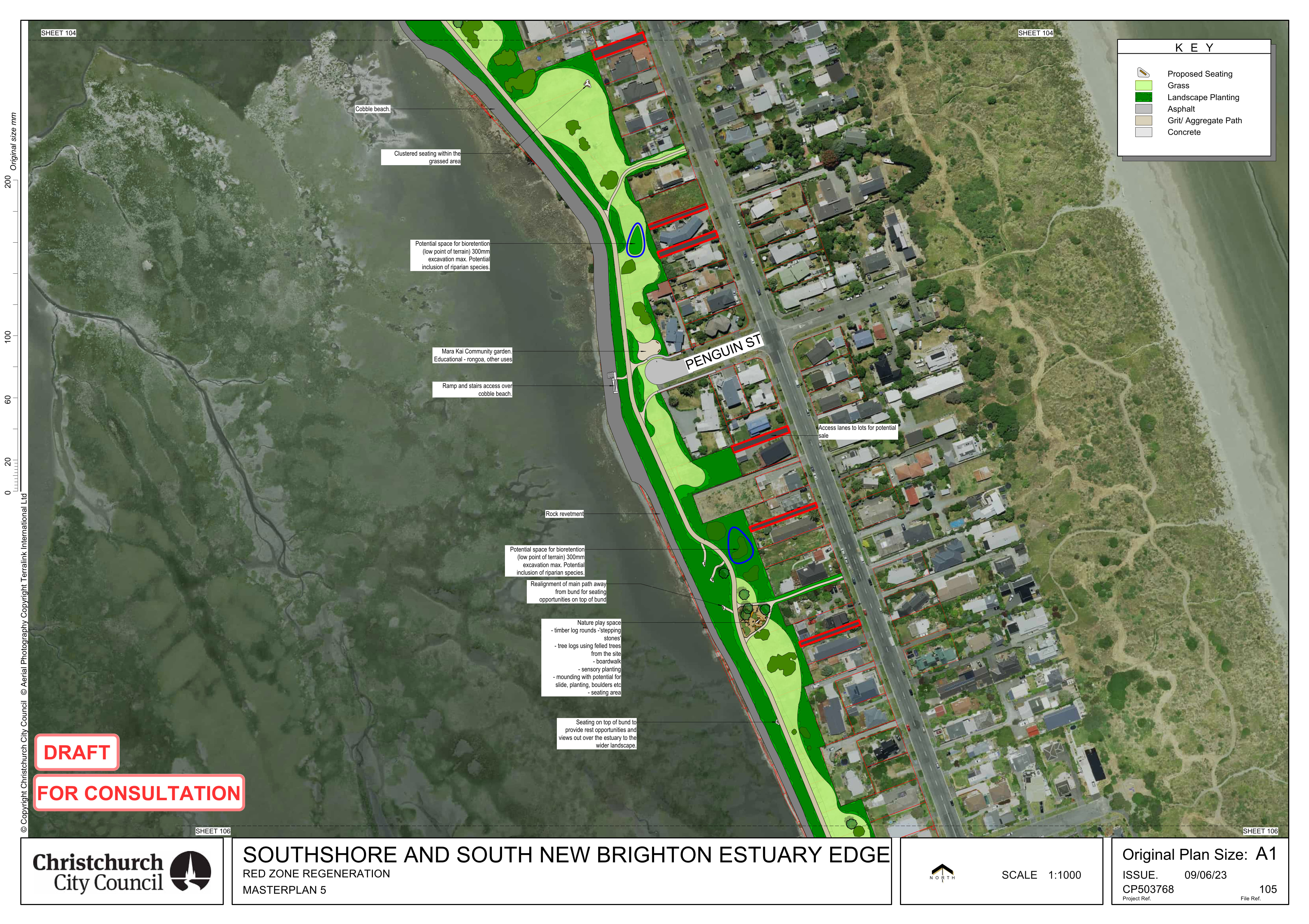
Southshore – Penguin
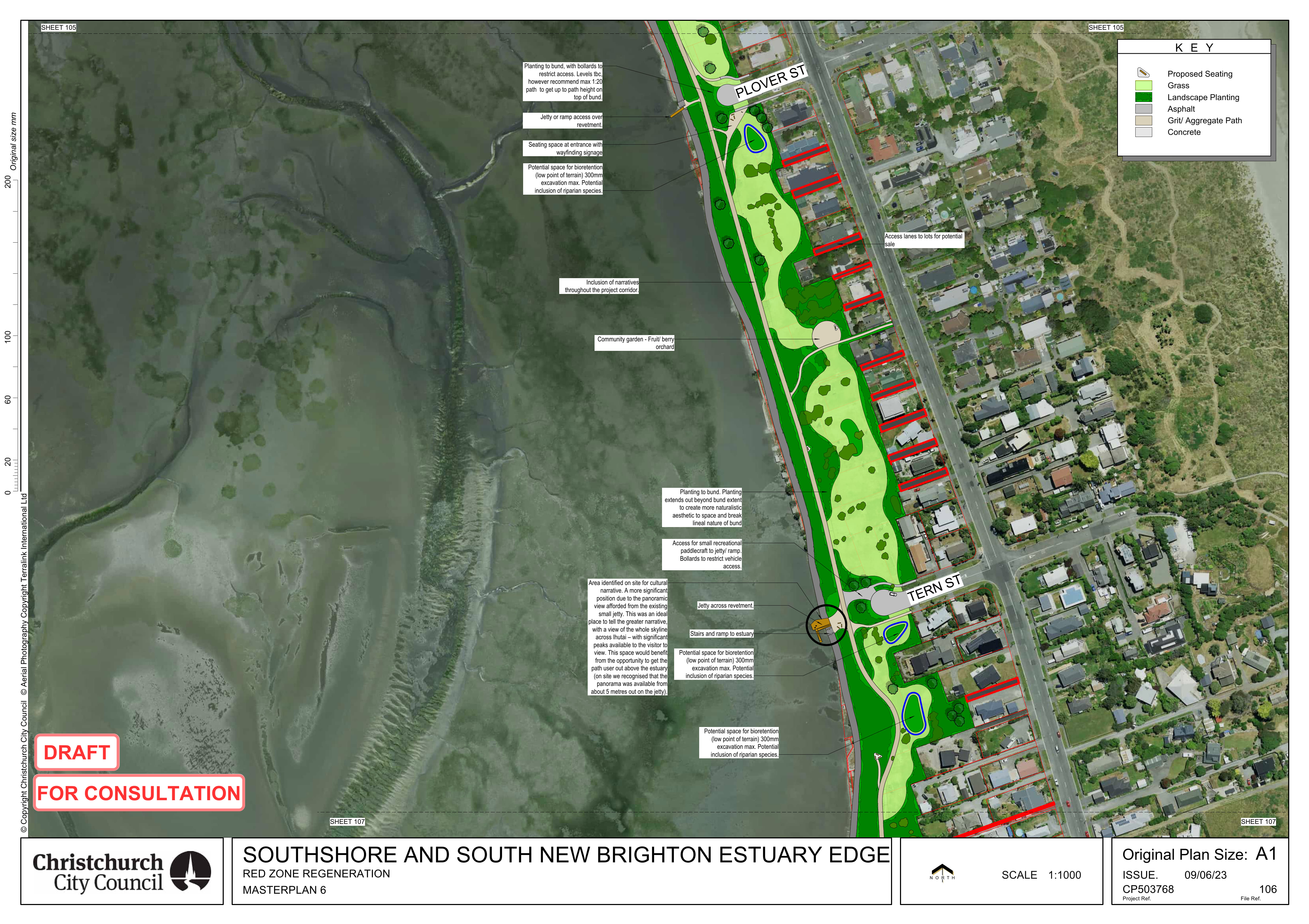
Southshore – Plover to Tern

Southshore – mermaid and Pukeko
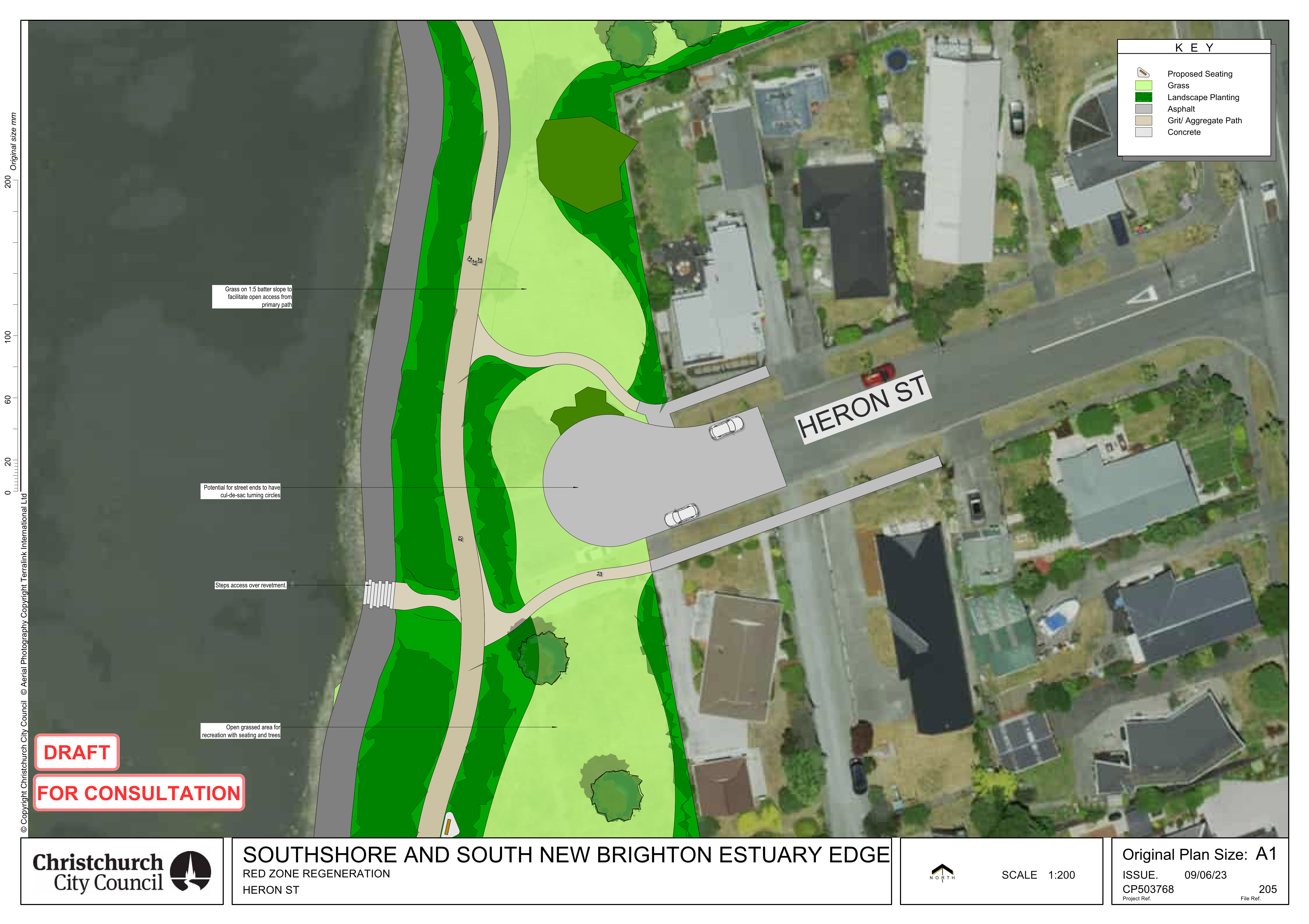
Heron Street – road end
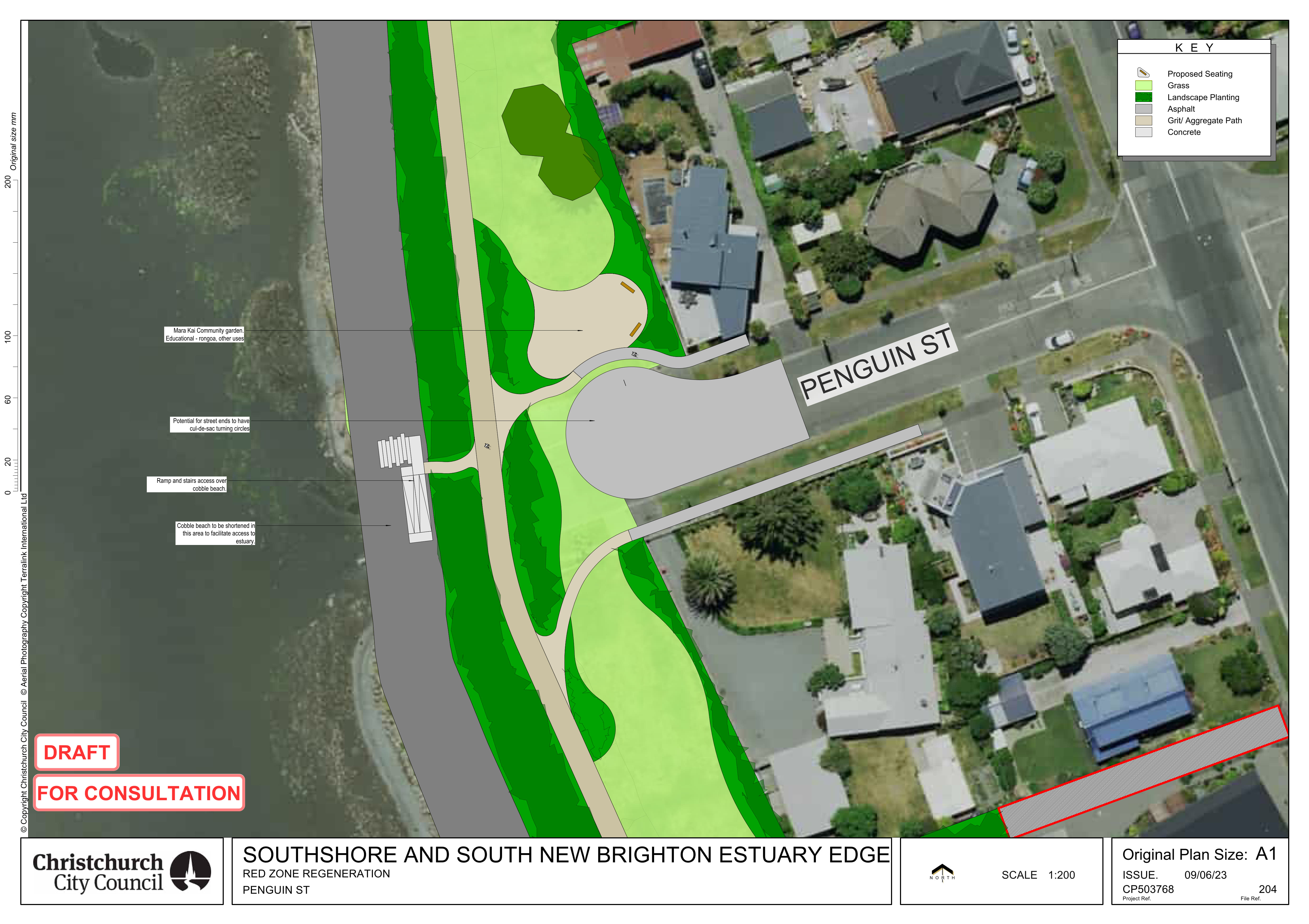
Penguin Street – road end

Plover Street – road end
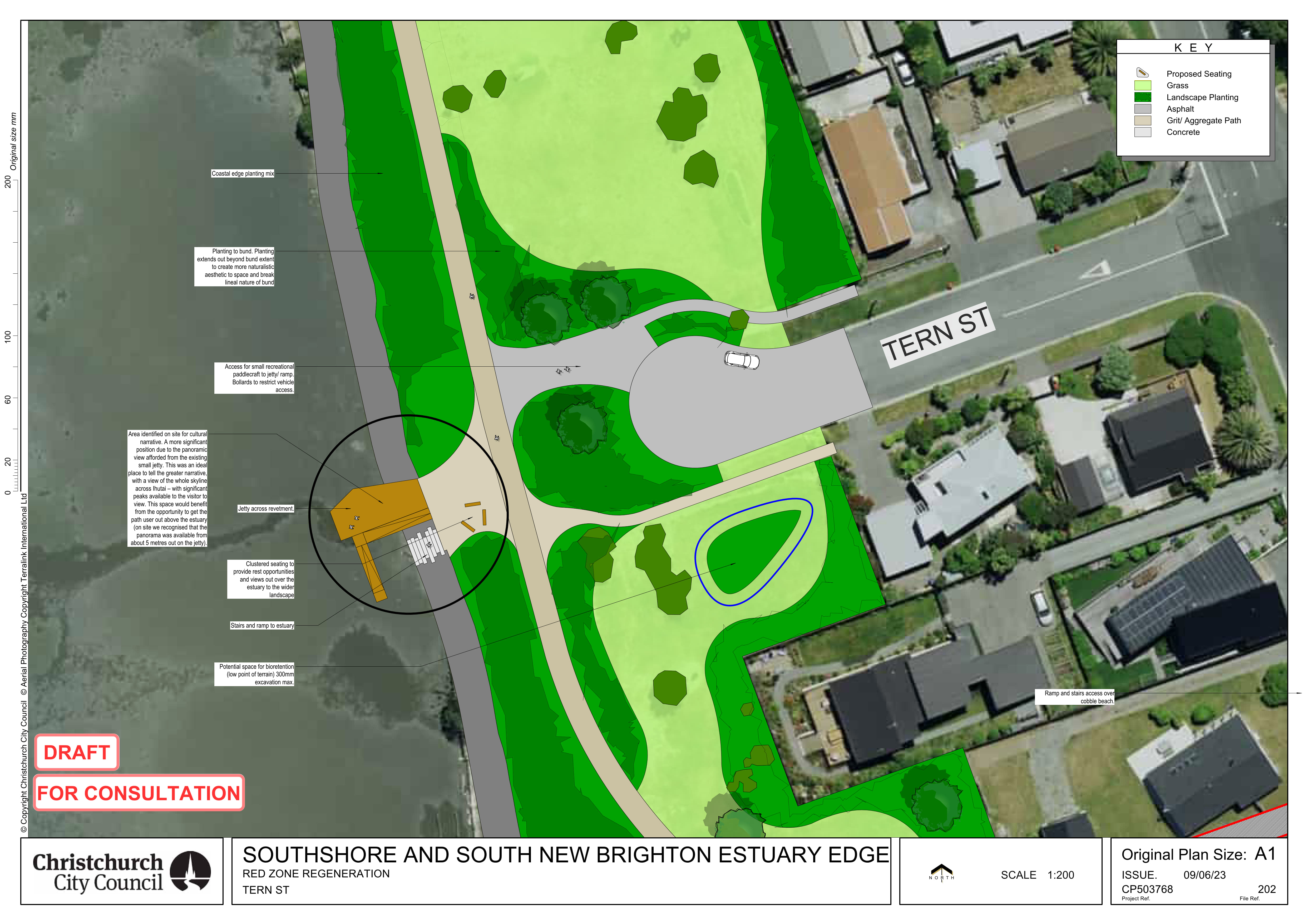
Tern Street – road end
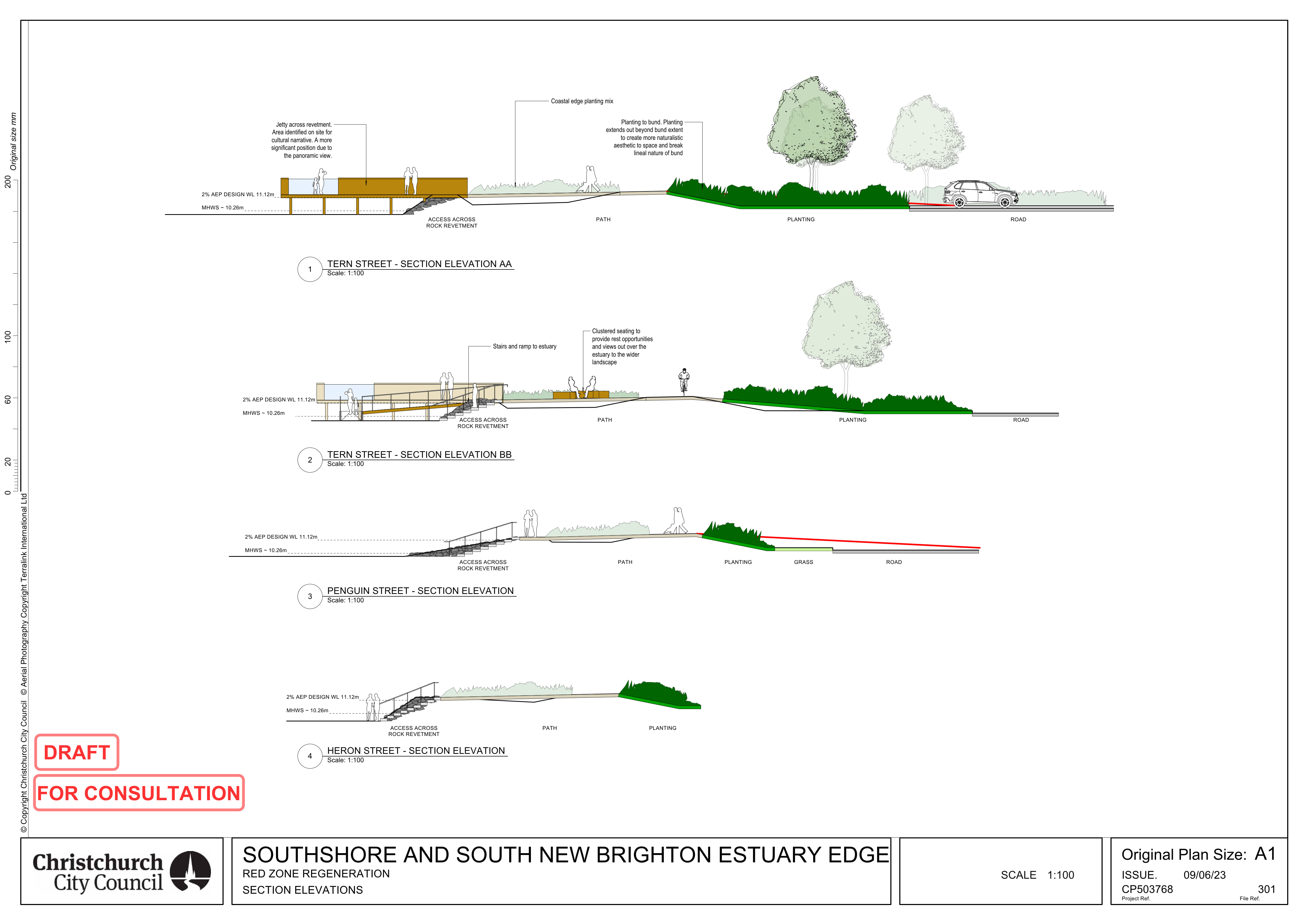
Heron, Penguin and Tern streets – design of estuary access
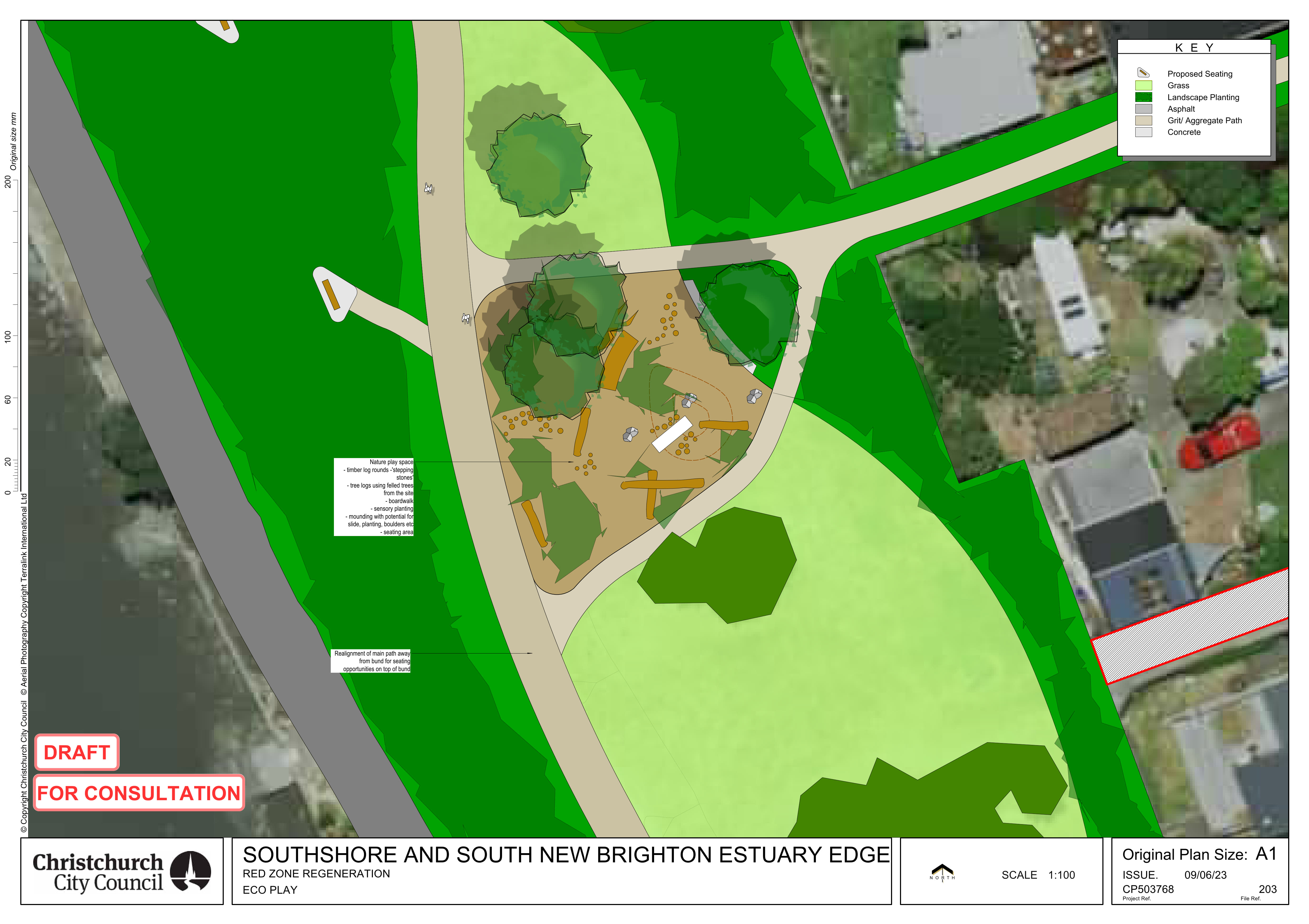
Nature play
The plans as PDFs
- South New Brighton Park - Beatty Street [PDF, 996 KB]
- South New Brighton Park - Jellicoe and Halsey Streets [PDF, 1.4 MB]
- South New Brighton Park - salt marsh and Estuary Road [PDF, 1.5 MB]
- Southshore - from Godwit Street to Heron Street [PDF, 907 KB]
- Southshore - Penguin Street [PDF, 983 KB]
- Southshore - Plover Street to Tern Street [PDF, 1.3 MB]
- Southshore - Mermaid Place to Pukeko Place [PDF, 867 KB]
Along the whole length of the project area there is a flood mitigation bund with a 3m wide walking track along the top. In Southshore the bund runs along the estuary edge. In South New Brighton Park the bund is more landward through the park, but the main path follows the estuary edge.
Additionally, in several areas which are low lying, we’re proposing swales and or rain gardens (which are shown as blue rings) to help store water so when it rains, water doesn’t drain into neighbouring properties. The purpose of the swales and or rain gardens is to manage rainfall runoff on the land.
Possible species proposed for the project area:
- Salt marsh Ribbonwood (Plagianthus divaricatus)
- Shore Spurge (Euphorbia glauca)
- Wiwi/ Knobby club rush (Ficinia nodosa)
- Sand Coprosma/ Tātaraheke (Coprosma acerosa)
- Small-leaved Pohuehue (Muehlenbeckia complexa)
- New Zealand Linen Flax (Linum monogynum)
- Shore bindweed (Calystegia soldanella)
- Native sand daphne (Pimelea prostrata)
- New Zealand spinach / kōkihi (Tetragonia trigyna)
We’ve had some consenting challenges with this project that have required considerable work to resolve and are the reason why it’s taken this long to get to this point. Ecological mapping of Southshore has identified some areas where the proposed design encroaches upon existing areas of saltmarsh, sea meadow and sea grass, as well as ‘at risk’ coastal bird populations and sites of cultural significance. Middens (archaeological sites) were identified close to the estuary edge in the South New Brighton Park and we have been working closely with the Ihutai Ahu Whenua Trust on how to protect these.
These landscape plans work together with the technical designs already agreed for the estuary edge. In 2020 Council approved a proposed approach to erosion mitigation in Southshore and South New Brighton. As a reminder of what is proposed:
- For the majority of the Southshore estuary edge, this means a rock revetment. In some places we’ll be putting rocks over the existing estuary edge structures, and in other places we need to remove excess material so that we end up with a consistent estuary edge that looks good and avoids certain ecological habitats.
- There is a small section in Southshore, around Heron and Penguin Streets, where we will create a cobble beach behind existing salt marsh. The cobble beach will provide the same level of protection as the rock revetment in the other areas.
- In South New Brighton Park we’ll be replacing the gabion baskets to the south of the Yacht Club, and then there will be a cobble beach in the remaining section around to the boardwalk.
Come along to see the landscape plans for the Southshore and South New Brighton estuary edge. Talk to the project team, and let us know what you think of what’s proposed.
Date: Saturday 17 June 2023
Time: 12:30pm - 4pm
Location: The Bridge, 51 Bridge Street, South Brighton