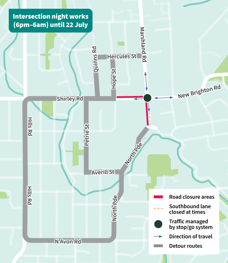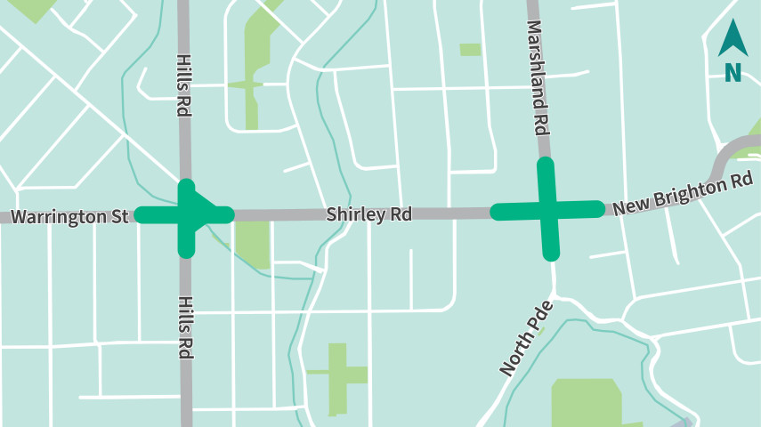
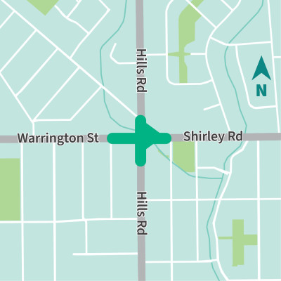
Work area for Shirley / Hills / Warrington intersection safety improvements
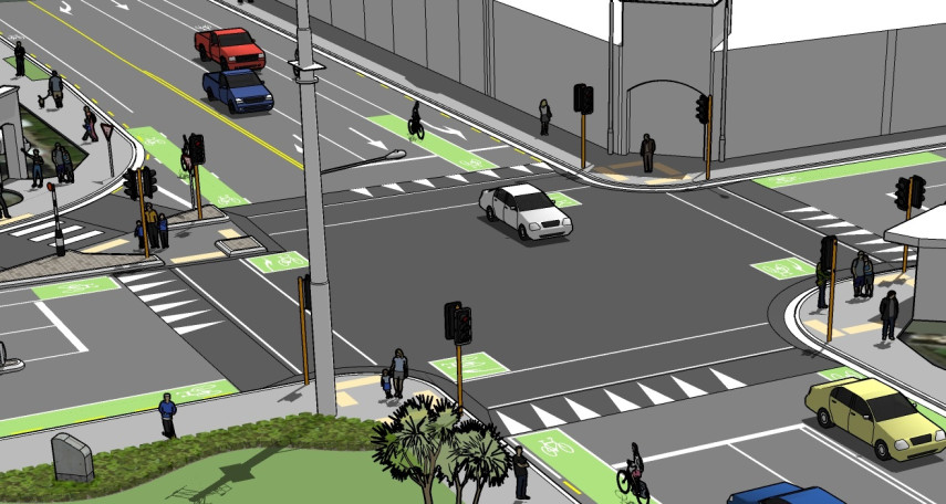
The safety improvements we've made at this intersection include:
- A raised safe-speed platform across the intersection to encourage safer speeds.
- Improved safety on slip lane/left turn from Hills Road through to Shirley Road with narrowed exit, speed cushion and speed hump.
- Improved safety on slip lane/left turn from Shirley Road to Hills Road with raised pedestrian crossing.
- Signal phasing changes, including a new green arrow for southbound right-turning vehicles travelling on Hills Road onto Warrington Street.
- Improved pedestrian crossing points, with new tactile pavers.
To minimise the need to come back again in the future, we also installed new, additional stormwater infrastructure while we were working in this area.
This project was approved by the Waipapa Papanui-Innes-Central Community Board on 15 February 2024.
We received submissions from five recognised organisations, one local business, and 173 individuals. You can read their feedback(external link) and find out how this influenced the community boards' decision(external link).