This section of the Crater Rim Walkway runs between Ahuriri Reserve, Mt Cass and Ellas Track.
| Start | Sign of the Bellbird, Summit Road, Port Hills |
|---|---|
| Finish | Sign of the Bellbird, Summit Road, Port Hills |
| Distance | 4 km |
| Time | 1.5 hours one way |
| Toilets | Located at the Sign of the Bellbird |
| Dogs | Dogs are prohibited from this section of the Crater Rim |
| Description |
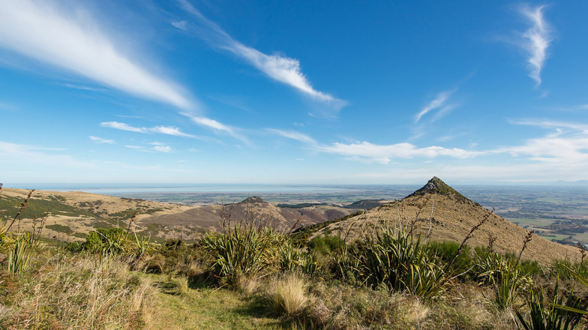
Past the Sign of the Bellbird, the track quickly heads into a lovely second-growth native forest full of well-established tree fuchsia and totara. Continue southwards through the grassy tops of Orongomai Reserve, passing through several bush remnants and rock outcrops. The track climbs away from near Summit Road and up onto the slopes of Coopers Knob/Omawete. At 573 m, the highest point on the Port Hills, the views down the length of Lyttelton Harbour are breathtaking. A short detour leading to the summit requires a little easy scrambling over rock – this can be slippery in wet weather. A descent through native bush brings you to the end of the Crater Rim Walkway at a car park opposite Ahururi Reserve. Ahuriri Reserve is a small pocket of bush tucked away on the plains side of the ridge. Carefully fenced, it has maintained its understorey and some fine examples of great old native trees. Get ready for this track using Plan My Walk(external link) by the NZ Mountain Safety Council. You can find track alerts, weather forecasts, trip reviews and a packing list, so you are set for your adventure. |
Walking tracks
Shared use
Connecting tracks
Closed

Parking

Bus stop

Toilets
Water fountains
Accessible tracks

Challenging feature

Entry and exit point

Point of interest
Related news
Central city on full display after long rebuild
After the 15th anniversary of the 22 February earthquakes, we’re taking a look at different Council aspects of the rebuild, and how far we’ve come. Next up, the central city.
27 Feb 2026
Ōtākaro Avon River Corridor shines, grows since quake
In the wake of the 15th anniversary of the 22 February earthquakes, we’re taking a look at different Council aspects of the rebuild, and how far we’ve come. Next up, the residential red zone's Ōtākaro Avon River Corridor (OARC).
26 Feb 2026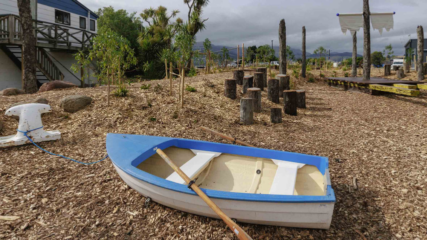
New play space at Lyttelton’s Naval Point now open
A ‘sinking ship’, monkey bars and dinghy are all features of a new play space at Naval Point.
14 Jan 2026