The coastal hazard assessment for the Ōtautahi Christchurch District.
Interactive hazard maps – Explore how your area may be impacted(external link)
2021 Coastal Hazard Assessment – Summary Report [PDF, 4.8 MB]
2021 Coastal Hazard Assessment – Full Technical Report [PDF, 144 MB]
The 2021 Coastal Hazard Assessment incorporates new topographic data, longer datasets (including beach profiles, water level information and wave climates), a new analysis of extreme water levels and sediment supply scenarios and an understanding of rising groundwater hazards due to sea-level rise.
It also covers the entire Ōtautahi Christchurch District coastline, including Banks Peninsula. It is a broad-scale assessment that provides a general indication of the magnitude and extent of hazards across neighbourhood-sized areas. However, it does not provide an assessment of the risk to individual properties or provide answers on what can be done to manage those hazards.
Inevitably, there are uncertainties. However, the data will allow us to broadly understand possible risks and support sound adaptation planning discussions with communities and robust decisions by the Council. By using a range of hazard scenarios in this assessment, it is not anticipated that further updates will be needed for a while.
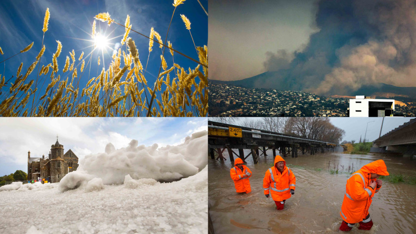
Ōtautahi Christchurch is very exposed to coastal hazards, and different areas will be impacted in different ways, and at different times. We have around 32,700 properties that could be at risk from coastal hazards with 1.5 metres of sea level rise, most commonly from coastal flooding.
We have many different ways for people to read, explore and understand the information, and get involved in our planning processes or make their own informed decisions in areas that might be at risk. To help with this we have created a technical report(external link), a shorter summary report, an online portal with interactive hazard maps(external link), and videos that describe the different coastal hazards and how they might impact different parts of the district over time.
Check out these easy-to-understand videos of why Ōtautahi Christchurch and Te Pātaka-o-Rākaihautū Banks Peninsula are at risk of coastal hazards and what we might expect to see happen over the next 20, 50 and 100 years as sea levels rise:
Unlike previous studies, the updated Coastal Hazard Assessment does not predict how much sea level will rise and by when. Rather than make any fixed assumptions, it considers a series of incremental changes in sea level rise from 0 to 2 metres to understand what could happen across the full range of scientifically credible scenarios for a sea-level rise between now and beyond 100 years (2150+).
We have a lot of new data which informed the assessment, including new topographic data, longer datasets (including beach profiles, water level information and wave climates), a new analysis of extreme water levels and sediment supply scenarios and an understanding of rising groundwater hazards due to sea-level rise.
This provided us with a better understanding of the local processes and conditions around the district so we didn’t need to make as many assumptions.
New research on the coastal sand budget provided new information on long term coastal processes for the open coast. We used this to understand how this coastline, which is currently accreting (building out), maybe impacted by erosion over time.
For more information on the latest data, see the following reports:
- The 2018 Coastal sand budget for Southern Pegasus Bay Stage A(external link), Stage B(external link), and peer review(external link) reports.
- The 2021 Joint risks of pluvial and tidal flooding report(external link) (including the new statistics).
- The 2020 Groundwater Report: Impacts of Earthquakes and Sea Level Rise on Shallow Groundwater Levels(external link).
The entire process was also overseen by an independent technical reviewer to add rigour and scrutiny, with additional oversight from Environment Canterbury coastal scientists.
More information on how the Coastal Hazard Assessment changed as a result of the independent technical review can be found here [PDF, 150 KB].
Representatives from community groups with interests in technical and environmental issues also provided feedback on communications and supporting information.
Because this is modelling, not measured change, there are uncertainties. Any modelling of future conditions of natural and social systems has uncertainties. This does not mean that the information is inaccurate, but the way the information is used and interpreted needs to reflect these uncertainties.
We undertook a detailed hazard assessment for all of the areas affected in Ōtautahi Christchurch but, in areas where less input data was available and fewer communities or assets are located, a regional hazard screening was undertaken. In areas where regional screening was used, which includes much of Banks Peninsula, fewer scenarios were assessed.
We did not model land subsidence. Recent monitoring shows that areas of Ōtautahi Christchurch have been slowly subsiding for the last 10-20 years. We have not modelled this because we don’t have a long enough record to know with any certainty whether this will continue and at what rate.
We have not assumed that mitigation structures will continue to work. We need a lot more information to understand and measure how these flooding and erosion mitigation structures would perform in the future, but we have mapped them so they can be considered in future management options
We only assessed areas close to the coast, where changes in future flood hazards are driven mostly by sea level rise and identified this area by an inland extent boundary on the maps. This is because there is a current gap in planning regulations and a need for long term adaptation plans in these areas. These areas will see the effects of sea level rise sooner or to a greater extent than inland areas.
Further inland, areas will also be affected by sea-level rise over time, but flooding is currently driven more by rainfall and river dynamics, which are already being managed through the district plan.
This new report supersedes the 2017 Coastal Hazard Assessment. However, it’s important to note that for some parts of the city where river and coastal flooding is combined, the previous Coastal Hazards Assessment continues to provide guidance on the risks of coastal flooding on river communities.
Further information about flood hazards for these areas further inland can be viewed on the Floor Level Map or District Plan Natural Hazards Maps(external link).
Sea levels have been rising over the past century globally. Scientists are confident that sea levels will continue to rise over the next century and beyond, but the rate and amount of future sea level rise is uncertain.
The 2017 Ministry for the Environment guidance(external link) recommends that Councils consider a range of possible sea level rise scenarios (from the low RCP2.6 to the high (upper estimate) RCP8.5H+) so that a plan can be developed to respond to whatever future effects happen.
To align with this, we chose a range of sea level rise values for each of these at different points in time ranging from just below through to just above the scenarios.
These national recommendations are based on the Intergovernmental Panel on Climate Change (IPCC) 5th Assessment Report(external link), which has recently been updated with the 6th Assessment Report(external link).
The updated projections broadly align with the previous ones, and because we have used increments of sea level rise for our assessment (as opposed to the specific RCP scenarios), we are able to account for the full range of updated sea level rise projections without needing to change our modelling.
The Council is legally required to include hazard information in a Land Information Memorandum (or LIM) if it is known to us.
LIM information about special features of the land, like other categorisations such as District Plan zones, helps anyone who is thinking about buying, building, repairing or investing in property to make informed decisions.
Public organisations and agencies like the Council also use this information to make sound decisions about building or rebuilding community facilities and infrastructure.
The 2021 Coastal Hazards Assessment will form the basis for notifications on Land Information Memorandums (LIMs). However, this won’t happen until mid-2022, to give people time to read the hazards information and understand the implications for their property.
LIM factsheet [PDF, 569 KB]
Because the assessment is at a broad scale, it provides a general indication of the hazards across the district.
It does not provide a detailed, assessment of the risk to individual properties, but it is possible to get a sense of potential impacts on and around properties in your neighbourhood. It is also not intended to provide answers on what can be done to manage those hazards.
The updated coastal hazards assessment will be used to inform our Coastal Hazards Adaptation Planning Programme. Adaptation planning is about preparing responses to reduce current and future risks for existing communities and infrastructure. When designing and implementing options, we will likely seek more site-specific information.
We’re also using the updated assessment as base information which has been analysed further to classify different levels of risk to inform our Coastal Hazards District Plan Change. This allows the community to provide feedback on whether the scenarios are suitable for the approach proposed in the district plan.
This plan change is about managing future development, redevelopment and changes in land use to avoid increasing risk, both now and in the future.
Related news
Upskill on climate change with UC – for free
Ōtautahi Christchurch residents will soon have free access to a new online learning course designed to build understanding and resilience in the face of climate change.
14 Oct 2025
World’s largest climate adaptation event coming to Christchurch
Ōtautahi Christchurch is set to welcome more than 1,200 global leaders, scientists, policymakers, and innovators who will gather next week to discuss how the world can adapt to climate change’s biggest challenges.
7 Oct 2025
News in brief from the Christchurch City Council meeting
Improvements on Moorhouse Avenue, speed limits around schools, tsunami sirens and Central City development contributions – here are the key decisions made at today's Christchurch City Council meeting.
18 Jun 2025