St Albans, Edgeware and Mairehau transport projects

We've made transport improvements in St Albans, Edgeware and Mairehau aimed at managing the traffic from the Christchurch Northern Corridor and improving connections for pedestrians and cyclists in the area.

Cranford Street crossing

Sign up for updates on traffic mitigation projects

The Christchurch Northern Corridor (CNC) is open and helping people travel to and from the north of Christchurch by extending the Northern Motorway to QEII Drive and Cranford Street. 

Further information about this project is available on the NZ Transport Agency website(external link).

The results of a survey undertaken within the neighbourhood during 2021 further informed the high-level project objectives for the study area, which includes Francis Avenue, Flockton Street, Cranford Street and neighbouring streets in the area.

Project objectives

These objectives were used to develop a long list of potential design options which could be implemented on the above streets.

  • To improve pedestrian and cyclist accessibility.
  • To improve general traffic safety.
  • To improve the efficiency of intersections.

All of the options were assessed using a multi-criteria assessment to better understand the impacts on safety, local residents and the surrounding network.

This was followed by a design workshop with technical experts from both the Council and Aurecon teams in February 2022 to come up with a shortlist of options to be taken forward for further investigation. 

We then undertook traffic modelling of the shortlist options to determine the potential impacts, both negative and positive, of their implementation. Based on the outputs of the traffic modelling we have developed a list of preferred design options which will be presented to the community for feedback and consideration.

Read the traffic modelling report [PDF, 19 MB].

Traffic calming Francis Avenue and Flockton Street

Traffic calming trials

We have trialled traffic calming measures on streets where a significant increase in traffic or speeding has occurred and there is support from the residents for changes.

We engaged with property owners and residents of Mersey Street, Thames Street, Francis Avenue and Flockton Street in November 2020, asking for feedback on traffic calming options and also any other ideas they may have.

We have trialled different measures on Francis Avenue (due to traffic volumes) and Thames Street (due to speeding issues) but these were removed due to the impact on surrounding streets.

Francis Avenue and Flockton Street 

In 2022, following feedback from residents in Francis Avenue and Flockton Street about increased traffic volumes and speeding, a traffic calming trial is underway in both streets over the same time period (22 August until 17 October 2022).

The trials are to work towards reducing speed and deterring vehicles from using Flockton Street and Francis Avenue as a short-cut route.  Once the trials end, staff will report back to the Waipapa Papanui-Innes Community Board and residents about traffic behaviour and monitoring data received during the trials. Plans will then be developed for wider consultation with the community.

Resident survey

We've completed the bulk of the road works downstream from the Christchurch Northern Corridor in St Albans, Edgeware and Mairehau, and we're continuing to monitor vehicle numbers travelling through the area. 

Our current focus is on the area bordered by Innes Road, Hills Road, Warrington Street and Cranford Street – especially Francis Avenue and Flockton Street as we are aware these two streets have experienced increased traffic volumes.    

As part of our monitoring work, we’ve surveyed residents to get a better idea of local priorities and concerns for particular streets. 

Results of the survey [PDF, 1.2 MB].

Over the last few months, Aurecon staff have been out doing onsite, in-person checks on the infrastructure issues that residents have identified in the survey. There have also been cameras up at some of the key intersections, capturing not just traffic counts but also driver behaviour at these locations.

This fieldwork has helped to validate the issues and develop a long list of possible solutions, with a particular focus on the following intersections:

  • Francis Avenue / Westminster Street
  • Francis Avenue / Warrington Street
  • Flockton Street / Westminster Street
  • Flockton Street / Warrington Street
  • Westminster Street / Cranford Street
  • Berwick Street / Cranford Street

The project team is now in the process of analysing and shortlisting these solutions against the project objectives, and early next year we’ll be back in touch to talk through possible solutions for your area.

Forfar Street cul-de-sac

We closed Forfar Street north of Warrington Street as part of the transport projects in St Albans last year.

The intersection of Forfar Street and Warrington Street is now a T-intersection making it safer for people walking and biking through the area, easier to get to Cranford Street and Barbadoes Street and quieter and safer for residents of local residential streets.

A formal consultation for the Forfar Street proposal was completed as part of the original scheme consultation in July and August 2019. This document was delivered to approximately 9,000 households including Berwick Street, Forfar Street, Francis Ave and Flockton Street.

The following consultation documents relate to Forfar Street:

Background

One of the main objectives of the downstream effects project is to ensure that the Christchurch Northern Corridor (CNC) traffic travelling through the area stays on the arterial roads rather than short-cutting through the local residential road network.

A preliminary analysis indicated there were local roads at risk of seeing a large increase in traffic flow from vehicles short-cutting through residential areas to avoid the arterial corridor.

The Downstream Effects Management Plan (DEMP) proposed traffic calming some of the local roads to discourage short-cutting, while providing a substantial capacity upgrade on arterial corridors, such as Cranford Street and either Sherborne Street or Madras Street and Barbadoes Street, to encourage traffic to stay on arterial roads.

This capacity upgrade would have included four lanes of traffic and intersection upgrades.

The two options recommended by DEMP were either providing four traffic lanes on the entire length of the Cranford – Sherborne corridor or providing four traffic lanes on Cranford Street between Innes Road and Berwick Street and two northbound traffic lanes on Madras Street and two southbound traffic lanes on Barbadoes Street.

The capacity increase on Madras and Barbadoes Street is to link in with the existing one-way system in the central city.

Through consultation with residents, key stakeholders and the affected Community Boards it was clear that the capacity upgrades were not preferred by the community. Therefore, additional assessments were carried out to investigate the local residential areas for short-cutting and alternative ways to keep traffic off those identified locations.

This work was completed to ensure the DEMP objectives were achieved without increasing the number of traffic lanes on arterial corridors.

An outcome of the assessment found that the closure of Forfar Street was a key intersection change to reduce short-cutting on the local roads. Forfar Street, north of Warrington Street, is classified as a local road. Despite this, traffic counts showed that it already had approximately 4,000 Average Weekday Daily Traffic (AWDT).

Modelling indicated with the opening of CNC the daily traffic volumes would increase to 7600 AWDT with particular increases in the morning and evening peak periods.

  • During the evening peak, the additional traffic using Forfar Street would then continue to travel north along other local roads, such as Thames, Severn, Mersey and Nancy prior to connecting back to Cranford Street and CNC.
  • During the morning peak, the traffic would travel in the reverse direction, potentially also coming from Knowles, Western, McFaddens and Jameson.

The capacity of the existing roundabout would not have been able to accommodate expected traffic flows at the Forfar/Warrington intersection. The upgrade to a signalised T-intersection provides more capacity for the turning movements to maintain traffic on arterial corridors.

The analysis also indicated (and is confirmed through the recent traffic monitoring data), that the Forfar Street closure at the Warrington Street intersection results in less traffic overall using all local streets north of Warrington Street during both peaks. It also indicated network-wide benefits in reducing the peak traffic flows on surrounding local streets.

The closure of Forfar Street and the upgrade of the Berwick Street and Warrington Street corridor has kept traffic on Cranford Street and off the local roads. The traffic monitoring confirms there has not been an increase in traffic volumes on Mersey, Thames, Severn and Forfar Streets.

The recent monitoring information for Forfar, Francis and Flockton also indicate an overall reduction in traffic on the three roads in this corridor. The below table summarises the average daily traffic volumes (ADT) and average weekday traffic volumes (AWDT) including during the trial period.

Monitoring period

Treatment

7 and 5 day average daily traffic volumes

Forfar Street

Francis Avenue

Flockton Street

Totals

2018 Pre-downstream effects works ADT (7 day) 3732 735 2220 6687
AWDT (5 day) 4080 796 2411 7287
Nov 2020 Pre-CNC opening, post-closure of Forfar Street ADT Not measured 1832 3103 4935
AWDT Not measured 2049 3384 5433
22 to 28 February 2021 Pre-trial ADT Not measured 1407 2493 3900
AWDT Not measured 1517 2595 4112
1 March to 7 March 2021 Week 1 trial left-in left-out Francis Ave ADT Not measured 1293 3438 4731
AWDT Not measured 1511 3771 5282
8 to 14 March 2021 Week 2 trial left-in left-out Francis Ave ADT Not measured 1015 3599 4614
AWDT Not measured 1143 4098 5241
15 to 21 March 2021 Week 3 trial left-in left-out Francis Ave ADT Not measured 955 3658 4613
AWDT Not measured 1096 4061 5157
22 to 28 March 2021 Week 4 trial left-in left-out Francis Ave ADT Not measured 958 3651 4609
AWDT Not measured 1080 4046 5126
29 March to 4 April 2021 Week 1 cul-de-sac trial Francis Ave ADT Not measured 380 3678 4058
AWDT Not measured 457 4234 4691
5 to 11 April 2021 Week 2 cul-de-sac trial Francis Ave ADT Not measured 267 3727 3994
AWDT Not measured 267 4092 4359
12 to 18 April 2021 Trials removed ADT Not measured 495 3961 4456
AWDT Not measured 363 4581 4944
19 to 25 April 2021 Post-trial ADT Not measured 1127 3015 4142
AWDT Not measured 1229 3352 4581

Safety

Upgrading the Forfar Street/Warrington Street roundabout to a signalised T-intersection allowed improvements to cyclist and pedestrian safety.

Typically vehicle crashes resulting in death or serious injury are less likely to occur on a roundabout than on a signalised crossroads. Roundabouts do not function well for cyclists or pedestrians with disproportionate levels of crashes and incident of death or serious injury.

Closing the northern approach of Forfar Street, and having a signalised T-intersection, results in fewer conflict points to manage. This means it is a safer intersection for all road users, particularly cyclists and pedestrians and overall it is a more efficient intersection resulting in more  traffic staying on the main arterial corridors.

Pedestrian and cycle network

While Forfar Street is closed to vehicle access, it remains open to cycles and pedestrians. This creates a safer and more efficient network for active and sustainable modes to the north of Warrington Street which supports and encourages modal shift.

Consultation

The consultation document was sent to approximately 9000 properties in the St Albans area which included information regarding the closure of Forfar Street at Warrington Street. 

We also ran a specific Facebook post related to this change which was shared with the St Albans Community page as part of highlighting the change at this intersection. 

We received 41 submissions (out of 253 submissions received) related to this proposed change.  This detail formed part of the overall consultation report which is one aspect taken into consideration (alongside technical information) when elected members make their decisions.

The intention has always been to carry out traffic calming for the surrounding local streets to reduce any impacts of changes to traffic volumes.  The engagement was carried out in November 2020 with property owners and residents of Mersey Street, Thames Street, Francis Avenue and Flockton Street. 

We asked for feedback on six traffic calming options and also any other ideas people may have.  During this engagement, two drop-in sessions were held on 10 and 11 November 2020 at Christchurch Park where there was an opportunity to discuss this further street by street.

All feedback received during this process helped informed what options would be trialled on each street. A summary of the submissions follows:

  • Francis Avenue - 31 submissions received. Main themes included support for a cul-de-sac in the middle of Francis Avenue (most popular option – 13 submissions), general feedback on how Francis Avenue is operating and concerns with speeding vehicles, safety and an increase in traffic.
  • Thames Street - 10 submissions received. Residents reported issues with speeding vehicles and other safety concerns. The majority of submissions supported traffic calming at the Innes Road end of Thames Street.
  • Flockton Street - 7 submissions received. The main themes were speeding vehicles, no speed humps, an increase in traffic and to adopt a wait and see approach.
  • Mersey Street - 8 submissions received. The main themes were no speed humps along with different traffic calming suggestions.

Forfar Street – changes to the closure

Any changes to the existing Forfar Street closure requires an assessment of the impacts, and consideration of the legal obligations from the CNC designation conditions.

The legal implications would likely be far-reaching and require a substantial traffic calming package on the local roads especially to the north of Westminster Street including the option of significant movement restrictions and loss of community connectivity.

It is also possible that additional capacity upgrades would be required on both Cranford and Sherborne Streets.

In addition, reopening Forfar Street would result in a less safe intersection, and compromise the ability of pedestrians and cyclists to use the local road network. Quiet residential streets that are a direct route are preferable for pedestrians and cyclists.

The costs associated with reopening Forfar Street would include possible re-consultation, physical works, signal upgrades and intersection modifications.

Further to this development, a much wider package of works for traffic calming and changes would be necessary to meet the designation conditions of the CNC.

Cranford Street bus lane trial

From the start of March to the end of June 2021 we trialled peak hour bus priority lanes on Cranford Street. 

The bus lane is currently operating:

  • city-bound from 7am to 9am
  • north-bound from 4pm to 6pm

The purpose of this trial to was to monitor the impact of having a dedicated bus lane on traffic volumes and on how people chose to travel in and through the area. 

During the trial, we invited feedback from residents on how they felt the bus lane was working. 

We are now analysing this feedback and other monitoring information, to help make a decision on whether the bus lanes should become permanent.  A review of the bus lanes will also be included in the work we are doing with traffic issues to the east of Cranford Street. 

August 2021 update

The bus lanes on Cranford Street will continue to operate while we work on design options for managing traffic on some of the residential streets east of Cranford Street. The trial was completed after three months but Councillors have decided to extend its operation until February 2022.

The data we’ve collected so far on the bus lane shows that it has offered a travel time saving for bus users while not impacting too much on traffic too much.

We want to leave our options open while we look at design options east of Cranford Street so that’s why we’re leaving the bus lane in place for now. Read more on Newsline.(external link)

If you have any questions or would like more information, please get in touch: cncdownstream@ccc.govt.nz.

Traffic count information.(external link)

Cranford Street upgrade

We are working with our partner organisations to mitigate the expected increase in traffic on Cranford Street and other streets in a way that:

  • keeps everyone safe
  • encourages walking, cycling and use of public transport
  • keeps people moving through the area

Operation of extra lanes on Cranford Street

Cranford Street was widened as part of the construction work last year. We are currently trialling peak hour bus priority lanes using this additional road space.

The operation of the Cranford Street corridor including the intersections will be reviewed by staff as part of plans for traffic calming and the review of the bus lane trial.

A right turn out of English Park has been banned to improve the safety and efficiency of this intersection.

Cycle routes

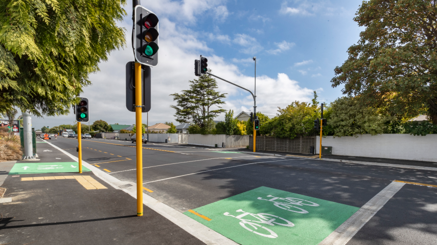
Cycle routes have been built to improve connections through the neighbourhood.

The Christchurch Northern Corridor has a shared path for pedestrians and cyclists running alongside it. A connection has also been built between this path and the Papanui Parallel.

It runs next to Cranford Street before turning west and linking with the Papanui Parallel at Rutland Reserve.

The on-road cycle routes have been built to offer east-west connections to the Papanui Parallel cycleway, as well as alternative north-south routes to connect to Madras Street and Barbadoes Street.

You can see how these fit together in the map below.

What else you need to know

We are working with our partners NZ Transport Agency, Waimakariri District Council and Environment Canterbury (ECan), on a package of projects that sit alongside the Christchurch Northern Corridor.

The projects include park-and-ride facilities, additional bus services and a high occupancy vehicle lane.

High occupancy vehicle lane

The NZ Transport Agency has installed a lane for vehicles with more than one person in them on State Highway One and the new Christchurch Northern Corridor motorway to encourage carpooling. This lane ends just before the Cranford Street roundabout.

Park-and-ride facilities

The Waimakariri District Council and NZ Transport Agency have built park-and-ride facilities in the district to encourage carpooling.

Bus services

ECan is providing direct bus services from Christchurch north that will travel along the Christchurch Northern Corridor and Cranford Street. 

Environmental monitoring 

We are collecting air quality and noise monitoring data so we can compare data from before and after the opening of the Christchurch Northern Corridor.

Air quality data is being collected on Cranford Street, Berwick Street, Madras Street and Barbadoes Street. We are working closely with ECan and have access to St Albans air-shed station.

We collected initial noise and vibration data at five sites on Springfield Road, McFaddens Road, Innes Road, Aylesford Street and Barbadoes Street.

The environmental monitoring sites have been chosen by independent experts.

Francis Avenue Special Amenity Area

The Special Amenity Area (SAM) defines the characteristics and design requirements for properties along Francis Avenue and suggests following the Integrated Transport Assessment (ITA) guidelines.

SAM does not include any specific requirements on daily traffic volume. However, Francis Avenue is characterised as a local residential street in District Plan and is currently designed to carry localised traffic.

Since the closure of Forfar Street, Francis Avenue has experienced increased traffic levels and staff are looking at developing options to manage traffic levels adequately.

Consultation feedback

Past consultations

Consultation on the projects took place in July and August 2019 and more than 50 changes have been made in response to feedback.

The street meetings we had planned for March/April 2020 about future traffic calming options/ideas for your street have been postponed.

This consultation followed two previous rounds in mid-2018 and early 2019. The key themes of the previous rounds of consultation were:

  • Moving people, not cars
  • Retaining a sense of community
  • Safety, particularly for people walking, biking and accessing local schools